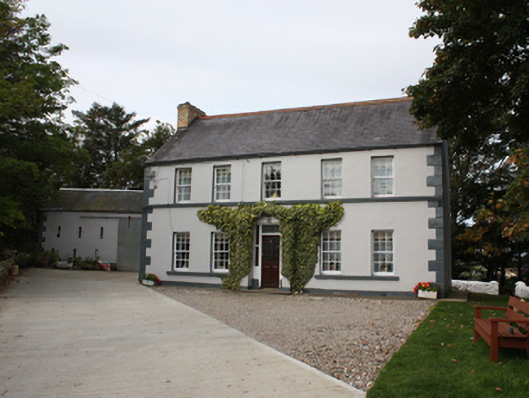
What is recorded here
Detached five-bay two-storey house, built c. 1890, with return and single-storey extension to rear and central porch to front. Pitched slate roof with clayware ridge tiles, gable ended yellow brick chimneystacks with cornice, cast-iron rainwater goods. Smooth rendered ruled-and-lined walls with block-and-start quoins,…
Read the whole record
From the Buildings of Ireland (National Inventory of Architectural Heritage) record 40900414
Places near here
Photo credits
- Maker not stated on source page, ru.pinterest.com
- National Inventory of Architectural Heritage
- Maker not stated on source page, global-geography.org
- Maker not stated on source page, en.wikipedia.org
- Michael Dibb, Geograph · Creative Commons Attribution-ShareAlike 2.0
- Michael Dibb, Wikimedia Commons · CC BY-SA 2.0
- David Dixon, Geograph · CC BY-SA 2.0
- michael clarke stuff, Wikimedia Commons · CC BY-SA 2.0
- Corinna Schleiffer, Geograph Ireland via Wikimedia Commons
- Dr Neil Clifton, Geograph · CC BY-SA 2.0
 Castle FortArchaeological place · 952 yd
Explorer Tom Castle Fort is recorded as an archaeological place in County Donegal, and its name suggests a spot where people built…
 farm house1.0 mi
Explorer Tom Farm house in Tully More is a c. 1800 survivor with that traditional open stone drain running from the door to the…
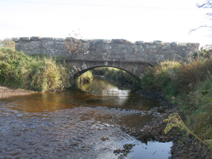 Keenagh BridgeBridge · 1.1 mi
Explorer Tom Keenagh Bridge has been spanning the river with a single limestone arch since c. 1860, its rock-faced voussoirs showing…
 Megalithic tomb in BallaghMegalithic tomb · 1.1 mi
Explorer Tom Megalithic tomb in Ballagh is basically a broken skeleton on a boggy ridge. Locals claim a coffin-shaped capstone used…
 Mapped cemeteryCemetery · 1.2 mi
Explorer Tom “Mapped cemetery” in County Donegal has a family tree that’s mostly made up by people who just wanted to sound…
 St. Mary's Catholic ChurchChurch/chapel · 1.2 mi
Explorer Tom Step into the grounds of St. Mary's Catholic Church in Lag, built back in 1784 and reportedly the first chapel of its…
 Lag GraveyardGraveyard · 1.2 mi
Explorer Tom Lag Graveyard lies in a natural enclosure of sandhills north of the Trawbreaga Bay channel. The survey found a short…
 Church (in Ruins)Church · 1.2 mi
Explorer Tom Church in Lag left a right angle of old masonry beside the modern church when surveyed. A small stone cross stood north…
 Holy well in DunagardHoly well · 1.5 mi
Explorer Tom Holy well in Dunagard is unlocated, but a 1936 account tells a lively story about nearby St Patrick's lake: fasting…
 Five Finger StrandBeach / strand · 1.6 mi
Explorer Tom Five Fingers Strand sounds as if the Atlantic has put up a hand to stop you, and at its northern end five rock stacks…
 Doagh Famine VillageMuseum · 2.1 mi
Explorer Tom Doagh Famine Village tells this coast's history through homes, voices and a guided tour. The original thatched…
 White StrandGuesthouse · 2.2 mi
Explorer Tom White Strand is probably white because it hasn't been cleaned since 1954, or maybe it’s just naturally that pristine.…
More historic places in County Donegal · All of County Donegal

What do you know about this place?Tap to add a comment or ask a question