Places near here
Photo credits
- National Inventory of Architectural Heritage
- N Chadwick, Geograph · CC BY-SA 2.0
- Carroll Pierce, Wikimedia Commons · CC BY-SA 2.0
- Patrice78500, Wikimedia Commons · Public domain
- Wanfried-Dublin, Wikimedia Commons · CC BY-SA 4.0
- Andreas F. Borchert, Wikimedia Commons · CC BY-SA 4.0
- Andreas F. Borchert, Wikimedia Commons · CC BY-SA 3.0 de
- Rossographer, Geograph · CC BY-SA 2.0
- Richard Webb, Wikimedia Commons · CC BY-SA 2.0
- Dr Neil Clifton, Geograph · CC BY-SA 2.0
 Dunree FortBattery · 1614 yd
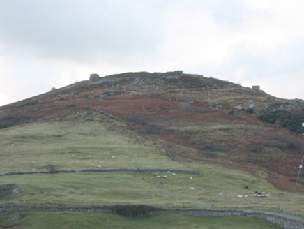
Explorer Tom Dunree Fort is a coastal battery with a two-storey gatehouse and sunken magazines that look like they’re hiding secrets from Lough Swill. It’s got high cement walls and pillboxes that are ready for action, even if nobody’s been there in ages. Go check out this impressive redoubt and see if the gun emplacements are still pointing the right way!
 Star of the Sea Catholic ChurchChurch/chapel · 1.1 mi
Explorer Tom Star of the Sea Catholic Church has a split bell tower and a low copper roof, a striking pair on a church built in 1964. Liam McCormick designed it as the third of seven Donegal churches. I would count the two halves from permitted ground first.
 Dunree CentreMuseum · 1.1 mi
Explorer Tom Dunree Centre is one building in the Fort Dunree grounds, where the fort's story takes six exhibition chapters to tell. I would give them proper time: a place that has watched over Lough Swilly for so long deserves more than a quick look at the view.
 Dunree HeadHeadland · 1.2 mi
Explorer Tom Dunree Head is always having a rivalry with more famous places further south, convinced it’s actually cooler because it gets to see the sunset first without all the crowds getting in its way. It doesn’t need your approval, but it does appreciate when you show up just as the light starts to get golden and dramatic. Go at sunset and thank me later.
 Urris HillsMountain / peak · 1.5 mi
Explorer Tom Urris Hills in County Donegal sounds like it's having a proper chat with the Gap of Mamore, judging by that caption. It’s a mountain that seems to know exactly where its boundaries are, even if the trail doesn't.
.jpg/250px-Ballyannan_(3).jpg "Photo: Wanfried-Dublin, Wikimedia Commons · CC BY-SA 4.0") Ballyannan Portal TombPortal tomb · 2.2 mi
Ballyannan Portal TombPortal tomb · 2.2 miExplorer Tom Ballyannan Portal Tomb is perched on Aghaweel Hill, offering a sprawling view across Lough Swilly to the Fanad mountains. It’s been standing in this exact roofless condition since at least 1846, so it’s got plenty of time to collect stories. The two tall portal stones are like ancient doorkeepers who never quite locked up.
 Saint Éigneach's WellHoly well · 2.4 mi
Explorer Tom Saint Éigneach's Well sits right on top of Mamore Gap, where pilgrims used to go barefoot around seven cairns. That’s a serious blister-fest, but apparently worth it for the spiritual glow-up at this mountain summit. There’s even a Lourdes grotto and Padre Pio statue nearby, so it’s got a very eclectic holy vibe.
 Mamore GapViewpoint · 2.4 mi
Explorer Tom Mamore Gap has an imaginary twin across the sea that argues with it over who gets the better sunset every single evening. It’s a whole thing, really, and the wind carries their bickering back to us like free entertainment. Toast it with a cup of tea and move on to the next.
 Mamore HillMountain / peak · 2.9 mi
Explorer Tom Right then, we've got ourselves a proper mountain called Mamore Hill tucked away in County Donegal. I imagine it's the sort of peak that looks like it’s been napping through the centuries, waiting for someone curious enough to poke its nose and see what’s over the ridge.
 Wild Atlantic Way:Ballymastocker StrandVisitor information · 3.0 mi
Explorer Tom Wild Atlantic Way:Ballymastocker Strand in County Donegal would post on social media that it’s 'too majestic for your average selfie stick,' which is exactly the kind of arrogance we’ve come to expect from it. The sand there holds grudges against anyone who digs too deep, and the sign above it looks permanently unimpressed by your efforts. Bring a map, get lost anyway, that's the fun.
 Ballymastocker StrandViewpoint · 3.0 mi
Explorer Tom Ballymastocker Strand Viewpoint would bring a very aggressive bag of crisps and a blanket with no pattern to any party, just to make sure everyone feels slightly uncomfortable. It’s the kind of place where you stand around wondering if you should be doing something more productive, like swimming, but the wind says otherwise. Grand place for a sulk or a snog, your call.
 Stragill BeachBeach / strand · 3.4 mi
Explorer Tom Stragill Beach in County Donegal ended up in this specific spot because it took a wrong turn at Buncrana and was too stubborn to admit its mistake. It’s been pretending ever since that this is exactly where it always wanted to be, despite the traffic. Whisper a secret at it, it's kept worse.
More historic places in County Donegal · All of County Donegal

What do you know about this place?Tap to add a comment or ask a question