What is recorded here
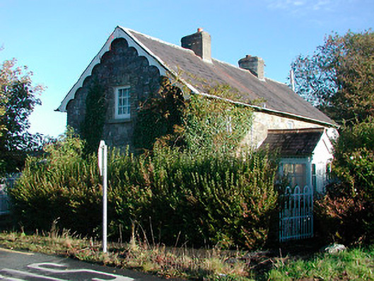
Detached three-bay two-storey house (with attic storey), built c.1820, having a projecting single-storey gable-fronted glazed timber porch to the centre of the front façade (east) with a natural slate roof and decorative bargeboards. Return to rear (west). Pitched natural slate roof with a pair of central smooth…
Read the whole record
Detached three-bay two-storey house (with attic storey), built c.1820, having a projecting single-storey gable-fronted glazed timber porch to the centre of the front façade (east) with a natural slate roof and decorative bargeboards. Return to rear (west). Pitched natural slate roof with a pair of central smooth rendered chimneystacks and decorative timber bargeboards to the south gable end. Rubble limestone walls with brick dressings to the openings. Square-headed window openings with cut stone sills and replacement windows. Square-headed doorcase to the front face of projecting porch with a timber panelled door. Located adjacent to rural crossroad junction with a wrought-iron gate to the southeast giving access to front garden and a wrought-iron gate to the southwest giving access to yard to rear (west). Located to the southeast of Mullingar to the north of Downs Bridge (15402651).
A charming small-scale house, of early nineteenth-century appearance, which retains much of its early character and form. This house has the feel of an estate cottage, although there are no large estates in close proximity to this site. This building retains much of its early fabric with the decorative bargeboards and the good quality glazed timber porch adding substantially to its picturesque appeal. Although the original windows have been replaced this property could be sympathetically refenestrated. This house is a charming addition to its pleasant rural location and is an integral part of the architectural heritage of the local area.
From the Buildings of Ireland (National Inventory of Architectural Heritage) record 15402650
Places near here
Photo credits
- JP, Geograph · CC BY-SA 2.0
- National Inventory of Architectural Heritage
- MookiePlays, Wikimedia Commons · CC BY-SA 4.0
- Bridget Neville, Wikimedia Commons · CC BY-SA 4.0
- Kieran Campbell, Geograph · Creative Commons Attribution-ShareAlike 2.0
- EecherplazGinkgo06.jpg : Cayambe derivative work: Ginkgotree ( talk ), Wikimedia Commons · CC BY-SA 3.0
- Mike Searle, Wikimedia Commons · CC BY-SA 2.0
- Andreas F. Borchert, Wikimedia Commons · CC BY-SA 4.0
- Sitomon, Wikimedia Commons · CC BY-SA 2.0
 bridge164 yd
 level crossing934 yd
 WoodfordHouse · 1178 yd
 sluice/sluice gate1.3 mi
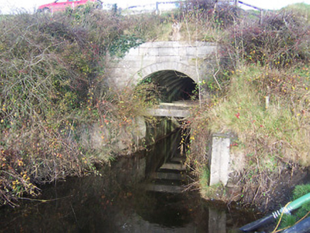 aqueduct1.6 mi
 Rattin CastleCastle, tower house · 5.2 mi
 Saint Brigid's WellSpring · 5.4 mi
 Fairy fort / earthen ringfort in ReynellaFairy fort / earthen ringfort · 5.5 mi
 Ginkgo5.7 mi
_-_geograph.org.uk_-_2494736.jpg/250px-Castles_of_Leinster,_Martinstown,_Westmeath_(2)_-_geograph.org.uk_-_2494736.jpg "Photo: Mike Searle, Wikimedia Commons · CC BY-SA 2.0") Martinstown Castle in RuinsCastle, tower house · 8.8 mi
Martinstown Castle in RuinsCastle, tower house · 8.8 mi Font (present location) in TowlaghtFont (present location) · 10.0 mi
 European Yew13 mi
More historic places in County Westmeath · All of County Westmeath

What do you know about this place?Tap to add a comment or ask a question