What is recorded here
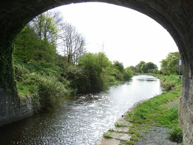
Single-arch hump-backed canal bridge carrying small road over Royal Canal, built c.1806. Constructed of dressed limestone with ashlar limestone detailing, including a projecting string course at parapet base level/road level, voussoirs to arch and coping over parapet walls. Towpath runs under bridge to the west.…
Read the whole record
Single-arch hump-backed canal bridge carrying small road over Royal Canal, built c.1806. Constructed of dressed limestone with ashlar limestone detailing, including a projecting string course at parapet base level/road level, voussoirs to arch and coping over parapet walls. Towpath runs under bridge to the west. Located to the southeast of Mullingar Town with rubble limestone walls running away to either end of bridge. Canal lock gates located adjacent to the north having timber balance arms and cast-iron fittings.
A typically well-built canal bridge, which is a valuable part of the architectural heritage of Westmeath and the industrial heritage of Ireland. Although humble in form, this structure has a simple and functional elegance. It is robustly built in fine stone masonry, which is testament to the long term ambitions of the Royal Canal Company at the start of the nineteenth century. The use of locally sourced material gives it a distinctive visual appeal and helps to integrate this feature into the local landscape. The timber lock/sluice gates to the north end are an unusual feature in that they don't appear to be associated with a canal lock as there is only one set of gates as opposed to the usual two pairs of gates.
From the Buildings of Ireland (National Inventory of Architectural Heritage) record 15402651
Places near here
Photo credits
- National Inventory of Architectural Heritage
- JP, Geograph · CC BY-SA 2.0
- MookiePlays, Wikimedia Commons · CC BY-SA 4.0
- Bridget Neville, Wikimedia Commons · CC BY-SA 4.0
- Kieran Campbell, Geograph · Creative Commons Attribution-ShareAlike 2.0
- EecherplazGinkgo06.jpg : Cayambe derivative work: Ginkgotree ( talk ), Wikimedia Commons · CC BY-SA 3.0
- Mike Searle, Wikimedia Commons · CC BY-SA 2.0
- Andreas F. Borchert, Wikimedia Commons · CC BY-SA 4.0
- Sitomon, Wikimedia Commons · CC BY-SA 2.0
 level crossing791 yd
 WoodfordHouse · 1209 yd
 bridge1.2 mi
 sluice/sluice gate1.3 mi
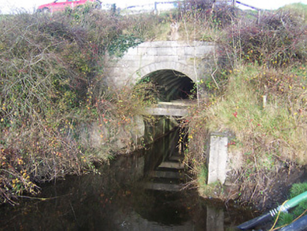 aqueduct1.6 mi
 Rattin CastleCastle, tower house · 5.2 mi
 Saint Brigid's WellSpring · 5.4 mi
 Fairy fort / earthen ringfort in ReynellaFairy fort / earthen ringfort · 5.6 mi
 Ginkgo5.8 mi
_-_geograph.org.uk_-_2494736.jpg/250px-Castles_of_Leinster,_Martinstown,_Westmeath_(2)_-_geograph.org.uk_-_2494736.jpg "Photo: Mike Searle, Wikimedia Commons · CC BY-SA 2.0") Martinstown Castle in RuinsCastle, tower house · 8.9 mi
Martinstown Castle in RuinsCastle, tower house · 8.9 mi Font (present location) in TowlaghtFont (present location) · 10.0 mi
 European Yew13 mi
More historic places in County Westmeath · All of County Westmeath

What do you know about this place?Tap to add a comment or ask a question