
What is recorded here
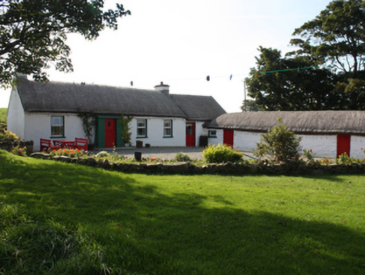
Detached four-bay single-storey vernacular thatched house, built c. 1800, with windbreak porch and bed outshot to rear. Pitched thatched roof with smooth rendered gable ended chimneystacks with rendered coping and smooth rendered gable coping. Roughcast rendered walls with smooth rendered porch, eaves and plinth course. Square-headed window openings with timber casement windows and painted reveals and sills. Square-headed door opening with glazed timber door. Several single-storey and two-storey outbuildings to front of house with pitched and lean-to corrugated tin roofs, whitewashed rubble stone walls and square door openings. Located to rear of modern dwelling off the main Malin to Culdaff road.
This vernacular thatched house still retains a sound external structure and good thatch and its characteristic bed outshot. It is typical of the small dwellings that were once common throughout the country. The rounded pitched roof, designed to minimise the impact of high winds, demonstrates a subtle adaptation of thatch roof construction, to accommodate local climatic conditions in exposed areas such as Inishowen. It is shown on the Ordnance Survey first edition six-inch map of c. 1837.
This does not grant access. Most recorded buildings are privately owned; view them only from public ground unless the owner allows entry.
Places near here
 IndicatedHoly well · 11 yd
 Cross in TemplemoyleCross · 198 yd
 St. Patrick's Catholic Churchchurch/chapel · 786 yd
 Faherna Cottagehouse · 1214 yd
 CastleCastle, unclassified · 2.6 mi
 CuldaffOfficial bathing water · 2.7 mi
 Carndonagh Early Church GraveyardGraveyard · 3.4 mi
 Lag GraveyardGraveyard · 5.1 mi
 Doagh Famine VillageMuseum · 5.1 mi
 Dough Famine VillageHeritage attraction · 5.1 mi
 Five Finger StrandBeach / strand · 5.3 mi
 Templemoyle Stone RingfortFairy fort / stone ringfort · 323 yd
Other information
Photo: National Inventory of Architectural Heritage · Website use allowed for educational or private purposes with source credit