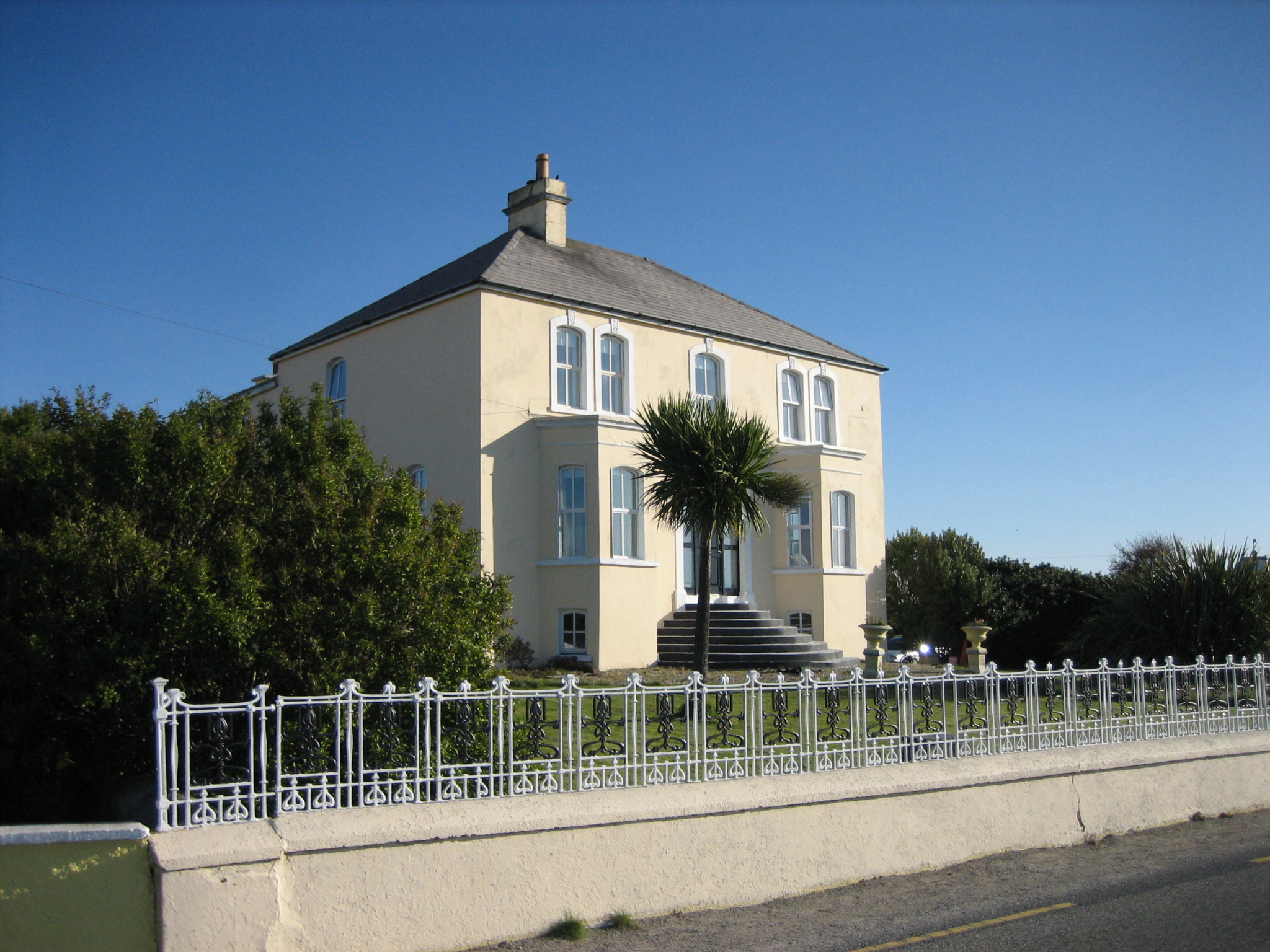
What is recorded here
Detached three-bay two-storey house over raised basement, built c.1910, having canted bay windows flanking entrance, and two-storey extension to rear. Hipped cement-tiled roof on raised eaves course with cast-iron rainwater goods, flat roof to canted bays with moulded parapet, flat roof to extension with rendered…
Read the whole record
From the Buildings of Ireland (National Inventory of Architectural Heritage) record 40904803
Places near here
Photo credits
- Eric Jones, Geograph · Creative Commons Attribution-ShareAlike 2.0
- Maker not stated on source page, www.pinterest.com
- Eric Jones, Wikimedia Commons
- National Inventory of Architectural Heritage
- P L Chadwick, Geograph · CC BY-SA 2.0
- Maker not stated on source page, readymap.irish
- Robert Bone, Wikimedia Commons
- Maker not stated on source page, en.wikipedia.org
- Maker not stated on source page, www.newstalk.com
 Saint Columba's Catholic ChurchChurch/chapel · 398 yd
Explorer Tom Saint Columba's Catholic Church has a rose window with quatrefoils that looks like a giant, very fancy flower. I bet it…
 The Wheelhouse CafeCafé · 404 yd
Explorer Tom The Wheelhouse Cafe in County Donegal absolutely loathes tourists who ask for decaf on weekends, claiming it ruins the…
 Burtonport Loops - Lúb Chroicheach MhórOfficial walking route · 581 yd
Explorer Tom Lúb Chroicheach Mhór is the Burtonport loop that begins by St Columba's Community Centre and gives an old railway line…
 Burtonport Erasmus Smith SchoolSchool · 728 yd
Explorer Tom Burtonport Erasmus Smith School has windows that look like they’re about to start singing hymns. Why would a…
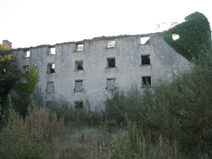 store/warehouse1110 yd
Explorer Tom Store or warehouse in Burtonport was built around 1850, perhaps using older walls from about 1780. The survey found its…
 The Lobster PotRestaurant · 1240 yd
Explorer Tom The Lobster Pot in Burtonport is known as Kelly’s, so don't be surprised if they call you by the wrong name. There…
 O’Donnell’sPub · 1263 yd
Explorer Tom O’Donnell’s in Burtonport is called Jimmy Johnny’s by locals, which proves names change faster than tides. It would…
 Harbour Front CafeCafé · 1287 yd
Explorer Tom Harbour Front Cafe in County Donegal is planning its early retirement by serving soggy rolls and dramatic fog to anyone…
 Burtonport Loops - Lúb Cheann Bhaile CruaicheOfficial walking route · 1338 yd
Explorer Tom Burtonport's Lúb Cheann Bhaile Cruaiche starts by the harbour and borrows an old railway line for a glorious Donegal…
 Tulaigh OileáinIslet · 1407 yd
Explorer Tom Tulaigh Oileáin has a retirement plan involving a very large pile of driftwood and a nap that lasts until the next…
 Inis MílIslet · 1508 yd
Explorer Tom Inis Míl in Donegal would introduce itself as a tiny rock that got lost and decided to stay put out of sheer…
 Bottom beachBeach / strand · 1.9 mi
Explorer Tom Bottom beach in County Donegal got its name because the map makers were too tired to come up with anything more…
More historic places in County Donegal · All of County Donegal

What do you know about this place?Tap to add a comment or ask a question