Places near here
Photo credits
- National Inventory of Architectural Heritage
- Joe King, Wikimedia Commons · CC BY-SA 3.0
- Alan James, Geograph · CC BY-SA 2.0
- Syncretists, Wikimedia Commons · CC BY-SA 4.0
- JP, Geograph · CC BY-SA 2.0
- JP, Wikimedia Commons · CC BY-SA 2.0
 bridge227 yd
Explorer Tom Piperstown’s bridge started when two lads bet they could cross it without falling in, and one of them lost his boots, which is now local legend. It’s simple and bold in the rural landscape, looking primitive but very confident about its geometric choices. Cheer from the side, but don’t jump over unless you’re sure.
 farm house250 yd
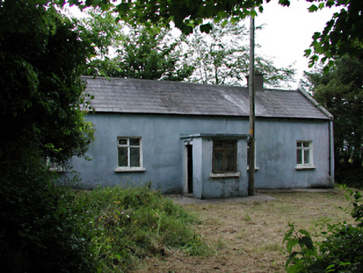
Explorer Tom Farm house in Piperstown is a humble cottage that has been growing into a proper farmstead over the years. It’s got barns stretching out to the east and a long history of use. Check out the buttresses on the stone barn for me!
CairnCairn, burial cairn · 1037 ydExplorer Tom Cairn in Piperstown is basically a stone circle that forgot how to stand up straight. It’s only half there, which feels very lazy for something supposed to be ancient and mysterious. I suspect it’s just hiding from the tourists who ask too many questions about its height. Bring a friend who talks too much and let the place shut them up.
Hellfire WoodForest · 1043 ydExplorer Tom Hellfire Wood in County Dublin has a bishop who refused to visit because he thought the fire was a bit too literal. It’s got more drama than a Shakespeare play, but with fewer actors and more actual flames. Walk past slowly like you're in a film noir, looking very brooding.
Dublin Mountains Way - Hellfire & Massey spurWalking route · 1164 ydExplorer Tom The Dublin Mountains Way Hellfire & Massey spur is a bit dramatic for a walk, isn't it? It sounds like you might catch fire or meet a guy named Massey. Keep an eye out for actual hellfire, though I doubt it's there.
 Montpelier HillMountain / peak · 1249 yd
Explorer Tom Dublin has a hill, a view and a lodge with a dreadful reputation. Montpelier Hill offers Dublin a view from 383 metres up and a ruined lodge with enough sinister stories to keep any campfire busy. Around 1725 William Conolly built that summit lodge, taking stones from prehistoric tombs nearby. The later Hellfire Club tales involve wild behaviour and darker rumours; the stone building is real, but the spookiest accounts are stories rather than a reliable guest list. Behind it you can still pick out remains of the old cairn. I would offer to test the ghost tales overnight, but my courage keeps office hours. Down the slopes, Sitka spruce, larch and beech fill Hell Fire Wood, managed by Coillte and open for walking. Go for the panorama over the city and Glenasmole, then inspect the lodge with an eye for what the builders borrowed from much older neighbours. The paths can be muddy and the hill is exposed, so dress for a proper walk. If you hear footsteps behind you, it is probably another walker. Probably.
Saint Ann's WellSpring · 1478 ydExplorer Tom Saint Ann's Well in County Dublin is definitely playing hard to get, maybe even harder than my ex. A Facebook pic suggests it might be in Nottingham, which is confusing. Trust your nose, not the map!
 Massey WoodWood · 1.3 mi
Explorer Tom Massey Wood has an imaginary twin across the sea that’s been sending it postcards about how much better the weather is over there, which Massey ignores with supreme dignity. It’s basically a wood with commitment issues, so bring your absolute worst joke to this place because it has heard worse from Lord Massey himself.
 St Columkilles WellHoly well · 1.7 mi
Explorer Tom St Columkilles Well in Oldcourt has a family tree that’s mostly made up, which is hilarious because it pretends to be so important and ancient. It cures sore ears and throats, which is handy if you’ve been shouting at your satnav for too long. Grand place for a sulk or a snog, your call.
 Ballymorefinn HillMountain / peak · 1.8 mi
Explorer Tom Ballymorefinn Hill in County Dublin overlooks a waterfall above Bohernabreena Reservoir. It’s a nice spot for a walk, as long as you don’t slip on the rocks and end up in the water like a clumsy tourist on holiday.
 Mount Venus CemeteryCemetery · 1.9 mi
Explorer Tom Mount Venus Cemetery in County Dublin was originally planned as an escape route for a very nervous vicar who couldn’t handle the pressure of his new parish. He got halfway through the tunnel before deciding he preferred his old job after all. A handy spot to stretch your legs and your imagination.
 Noel Lemass MemorialMemorial · 2.3 mi
Explorer Tom Noel Lemass Memorial in County Dublin marks where a captain died in 1923 so the republic might live. That is very serious stuff! The inscription says his body was found on this spot. Stand there quietly for ten seconds to show some respect!
More historic places in County Dublin · All of County Dublin

What do you know about this place?Tap to add a comment or ask a question