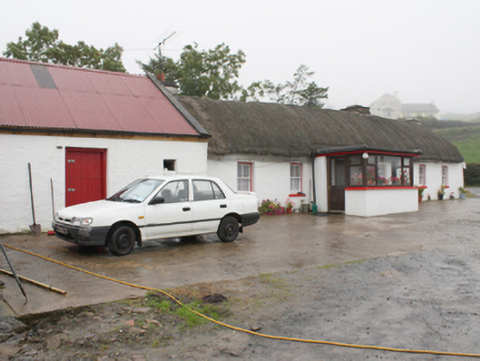
What is recorded here
Detached six-bay single-storey vernacular thatched house built c. 1820, with modern flat-roof porch to front, flat-roof extension to rear and outbuilding to gable. Rounded pitched thatched roof and rendered chimneystacks with rendered coping. Smooth rendered whitewashed walls. Square-headed window openings with…
Read the whole record
From the Buildings of Ireland (National Inventory of Architectural Heritage) record 40900506
Places near here
Photo credits
- National Inventory of Architectural Heritage
- Andreas F. Borchert, Wikimedia Commons · CC BY-SA 4.0
- Kenneth Allen, Geograph · CC BY-SA 2.0
- Kenneth Allen, Wikimedia Commons · CC BY-SA 2.0
- James Emmans, Geograph · CC BY-SA 2.0
- Corinna Schleiffer, Wikimedia Commons · CC BY-SA 2.0
- Patrick Mackie, Geograph · CC BY-SA 2.0
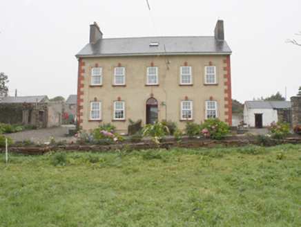 Carthage HouseHouse · 1175 yd
Explorer Tom Carthage House in Carthage is a real survivor from 1775, wearing its classical front like a proud badge. The round-headed doorcase is stripped back to the barest elements, which makes it look incredibly impressive. It’s one of the most substantial private houses surviving in this part of Donegal.
 Donowen Promontory FortPromontory fort, coastal · 1741 yd
Explorer Tom Donowen Promontory Fort hides shapeless stone mounds that might be the ghost of a 16th-century O'Doherty castle. That’s a wild, salty possibility right there on the cliff edge. That rubble could be a fragment of a forgotten nobleman’s drama.
 CastleCastle, unclassified · 1751 yd
Explorer Tom Castle in Carthage may survive only as shapeless stone mounds on a promontory. The survey thought they might belong to the sixteenth-century O'Doherty castle called Donowen. A wall closed the landward side, while another guarded a sea approach. Those defences are recorded; the exact shape of the lost castle is not.
 Iron Age Promontory FortArchaeological place · 1.0 mi
Explorer Tom Iron Age Promontory Fort is perched right over that wild stretch of Girt Bay. I can hear the waves arguing about who owns the rocks down there. It looks like a dragon’s jaw snapping at the tide.
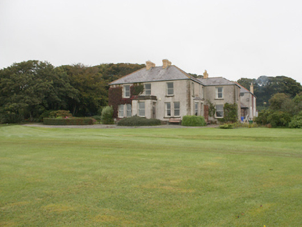 Dunowen HouseHouse · 1.0 mi
Explorer Tom Dunowen House overlooks Culdaff Bay in the building inventory. That account says it was reputedly built in 1899 as a summer house for letting, then sold by Robert Fleming in 1929 after losses linked to the Wall Street Crash. A striking turn for the house with sash windows and a sea-facing setting.
 Culdaff ArmsPub · 1.5 mi
Explorer Tom Culdaff Arms is definitely where you go if your arm hurts from carrying too many bags. The name suggests heavy lifting or perhaps just tiredness. Stretch out those shoulders!
 McGuinness’Pub · 1.5 mi
Explorer Tom McGuinness’ in Culdaff Main Street probably has a sign that says 'No Dogs Except This One.' I bet the owner knows every dog in the village by name. Pet the good ones.
 CuldaffOfficial bathing water · 1.6 mi
Explorer Tom Culdaff Beach looks as if three pieces of the map agreed to meet for tea: dunes to the west, two rock outcrops to the southeast, and the Culdaff River to the northwest. The sand has quite a supporting cast. This protected coast deserves a gentle visit.
 Tremone BayBeach / strand · 5.0 mi
Explorer Tom Tremone Bay has been keeping an icy secret in its rocks. Geological Survey Ireland records debris dropped by ancient ice in the bedrock at White Strand’s northwest end, roughly 590 to 570 million years old. I cannot blame the beach for looking smug; most places would brag about a history half that long.
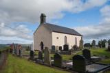 Carndonagh Early Church GraveyardGraveyard · 5.4 mi
Explorer Tom Carndonagh Early Church Graveyard makes me slow the map down: it surrounds an eighteenth-century church thought to stand where an earlier church stood. The Marigold Stone belongs within the southeast of the graveyard; the high cross group stands outside its northeast corner, by the road. Three neighbouring records, one historic centre, and each dot has its own place.
 CrockavishaneMountain / peak · 7.8 mi
Explorer Tom We have a whole view of Crockavishane in County Donegal, and I promise the scenery is as lovely as this cheeky explorer’s imagination suggests.
 CrockaulinMountain / peak · 8.7 mi
Explorer Tom Crockaulin offers a lonely triangulation pillar that stares down at Greencastle from a dizzying height. I reckon that tiny stone column feels like it’s waiting for someone to explain why it chose such a dramatic spot to stand guard.
More historic places in County Donegal · All of County Donegal

What do you know about this place?Tap to add a comment or ask a question