What is recorded here
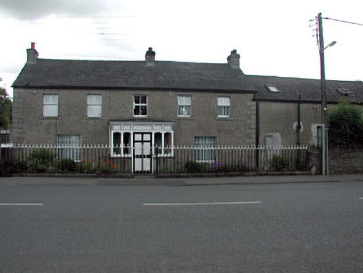
Detached five-bay two-storey house, c.1880, with single-bay single-storey flat-roofed projecting porch to centre. Reroofed, c.1970. Refenestrated, c.1990, possibly with openings remodelled to ground floor. Gable-ended roof. Replacement artificial slate, c.1970. Concrete ridge tiles. Rendered chimney stacks.…
Read the whole record
From the Buildings of Ireland (National Inventory of Architectural Heritage) record 11815022
Places near here
Picture notes
- National Inventory of Architectural Heritage
- Alvesgaspar, Wikimedia Commons · CC BY-SA 3.0
- Computer-made picture. It does not show this playground.
- Sitomon, Wikimedia Commons · CC BY-SA 2.0
- GothmogLord, Wikimedia Commons · CC BY-SA 3.0
- Ian Paterson, Geograph · CC BY-SA 2.0
- Colin Park, Geograph · CC BY-SA 2.0
- Mega Phil, Wikimedia Commons · CC BY-SA 4.0
- Mike Searle, Geograph · CC BY-SA 2.0
- Ridiculopathy, Wikimedia Commons · CC0
- JP, Geograph · CC BY-SA 2.0
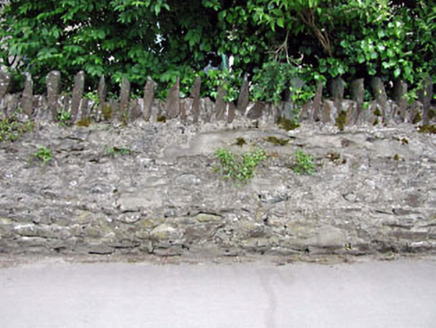 gates/railings/walls17 yd
Explorer Tom Gates in Killhill has caught my eye in Killhill, County Kildare. I bet a gates/railings/walls with a name like that could keep me talking all afternoon; I'm already inventing a daft little scene for it, and I'll stop before it turns into history.
 water pump25 yd
Explorer Tom Water pump in Kill East has caught my eye in Kill East (Kill Ed), County Kildare. I bet a water pump with a name like that could keep me talking all afternoon; I'm already inventing a daft little scene for it, and I'll stop before it turns into history.
 Common Lime1.2 mi
Explorer Tom Common Lime has caught my eye in County Kildare. I bet a common lime with a name like that could keep me talking all afternoon; I'm already inventing a daft little scene for it, and I'll stop before it turns into history.
 Children's playground1.8 miComputer-made picture. It does not show this playground.
Explorer Tom Children's playground has caught my eye in County Kildare. I bet a children's playground with a name like that could keep me talking all afternoon; I'm already inventing a daft little scene for it, and I'll stop before it turns into history.
 European Yew1.8 mi
Explorer Tom European Yew has caught my eye in County Kildare. I bet a european yew with a name like that could keep me talking all afternoon; I'm already inventing a daft little scene for it, and I'll stop before it turns into history.
 Oughterard Round TowerHeritage attraction · 2.2 mi
Explorer Tom Oughterard Round Tower has caught my eye in County Kildare. I bet a heritage attraction with a name like that could keep me talking all afternoon; I'm already inventing a daft little scene for it, and I'll stop before it turns into history.
 Reeves CastleCastle · 4.1 mi
Explorer Tom Reeves Castle has caught my eye in County Kildare. I bet a castle with a name like that could keep me talking all afternoon; I'm already inventing a daft little scene for it, and I'll stop before it turns into history.
 Cupidstown HillMountain / peak · 4.2 mi
Explorer Tom Cupidstown Hill has caught my eye in County Kildare. I bet a mountain / peak with a name like that could keep me talking all afternoon; I'm already inventing a daft little scene for it, and I'll stop before it turns into history.
 Punchestown LongstoneArchaeological place · 4.3 mi
Explorer Tom Punchestown Longstone has caught my eye in County Kildare. I bet a archaeological place with a name like that could keep me talking all afternoon; I'm already inventing a daft little scene for it, and I'll stop before it turns into history.
 Castle RagCastle · 4.6 mi
Explorer Tom Castle Rag has caught my eye in County Kildare. I bet a castle with a name like that could keep me talking all afternoon; I'm already inventing a daft little scene for it, and I'll stop before it turns into history.
 Brides WellHoly well · 4.7 mi
Explorer Tom Brides Well has caught my eye in Newtown Great, County Kildare. I bet a holy well with a name like that could keep me talking all afternoon; I'm already inventing a daft little scene for it, and I'll stop before it turns into history.
 Grand Canal WayWalking route · 6.1 mi
Explorer Tom Grand Canal Way in County Dublin is pretending to be Kildare according to one cheeky map note. A little county peninsula poking through like a nosy neighbour. Tell me if it's still hiding!
More historic places in County Kildare · All of County Kildare

What do you know about this place?Tap to add a comment or ask a question