
What is recorded here
Detached three-bay single-storey vernacular house, built c. 1860, having modern entrance porch and extension to the front elevation (east) Now in use as outbuilding with ruined single-storey outbuildings attached to south gable. Pitched thatch roof with smooth rendered gable-ended chimneystacks. Roughcast rendered…
Read the whole record
From the Buildings of Ireland (National Inventory of Architectural Heritage) record 40902127
Places near here
Photo credits
- Kenneth Allen, Wikimedia Commons · CC BY-SA 2.0
- National Inventory of Architectural Heritage
- Maker not stated on source page, storage.googleapis.com
- Maker not stated on source page, www.irelandbeforeyoudie.com
- Humphrey Bolton, Geograph · Creative Commons Attribution-ShareAlike 2.0
- Maker not stated on source page, en.wikipedia.org
- Maker not stated on source page, www.tripadvisor.ie
- Richard Webb, Wikimedia Commons
- Kenneth Allen, Geograph · CC BY-SA 2.0
- Picture: Barrack Hill Town Park
 CroaghmoreMountain / peak · 927 yd
Explorer Tom Croaghmore in County Donegal would win a county fair easily, simply by standing still and looking vaguely impressive…
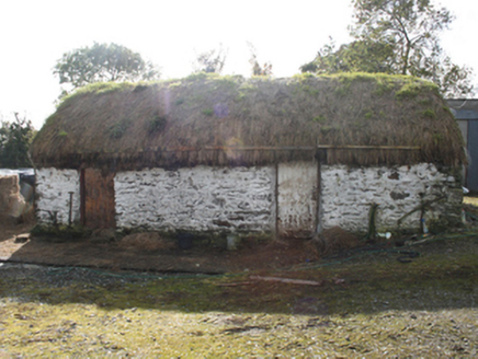 outbuilding1.7 mi
Explorer Tom Outbuilding in Ballyargus is a c. 1860 survivor with whitewashed random rubble walls that look like a daft patchwork…
 Ballyargus Children's Burial GroundChildren's burial ground · 1.8 mi
Explorer Tom Ballyargus Children's Burial Ground is cut in half by a field boundary, which feels a bit rude. You’ve got faint traces…
 Glentogher Wedge Tomb / CarrowmoreWedge tomb · 1.8 mi
Explorer Tom Glentogher Wedge Tomb / Carrowmore is deeply embedded in bog on a terrace overlooking the Glentogher River. It’s not…
 Church of St. ColumbaChurch/chapel · 2.3 mi
Explorer Tom Church of St. Columba sits high above the main road, keeping its eyes fixed on Lough Foyle since its dedication in…
 Site of White CastleCastle, unclassified · 2.8 mi
Explorer Tom Site of White Castle is where a man named Brian age McLaughlin hung out in 1601. The structure is totally gone, leaving…
 Redcastle Oceanfront Golf & Spa HotelHotel · 2.9 mi
Explorer Tom Redcastle Oceanfront Golf & Spa Hotel claims oceanfront status, which is generous for Donegal's rough coastline where…
 Quigley's PointHeadland · 3.7 mi
Explorer Tom Quigley's Point is where eastern Inishowen leans towards Lough Foyle and Donegal shows it can be quietly fascinating as…
 Cruckahenny TrailOfficial walking route · 3.8 mi
Explorer Tom Cruckahenny Trail takes you from Quigley's Point into the hills above Lough Foyle, and Donegal has arranged the climb…
 Orchard BarPub · 4.6 mi
Explorer Tom Orchard Bar in County Donegal has an unlikely celebrity friend who only visits when the cider is fresh. I’d bet they…
 Old Burial GroundGraveyard · 4.7 mi
Explorer Tom Old Burial Ground in County Donegal has a retirement plan that involves turning into a popular picnic spot by 2050.…
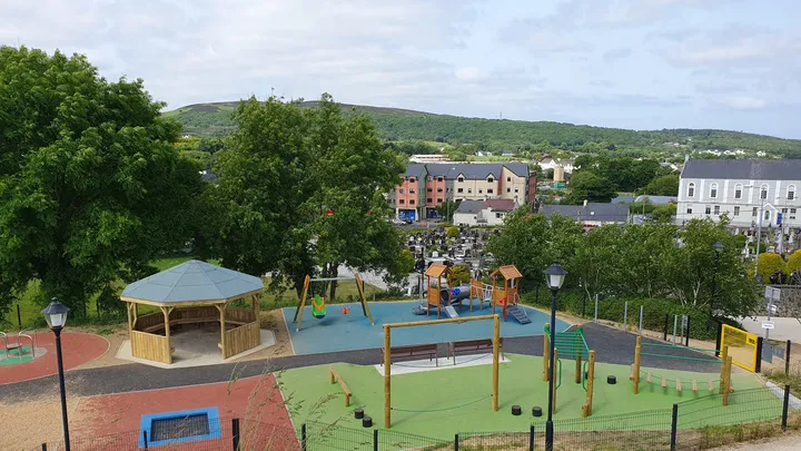 Barrack Hill Town Park PlaygroundChildren's playground · 5.7 mi
Explorer Tom At Barrack Hill, little legs get the climbing frames, swings, balance beams and monkey bars. The roundabout was…
More historic places in County Donegal · All of County Donegal

What do you know about this place?Tap to add a comment or ask a question