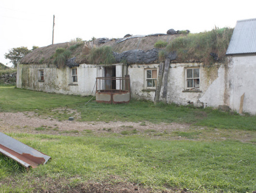
What is recorded here
Detached five-bay single-storey vernacular house, built c. 1800, with windbreak porch to front, in use as outbuilding. Rounded pitched thatched roof with netting restraint and metal rope stays to eaves. Flat concrete roof to porch. Roughcast rendered rubble stone walls. Square-headed window openings with two-over-two…
Read the whole record
From the Buildings of Ireland (National Inventory of Architectural Heritage) record 40901238
Places near here
Photo credits
- National Inventory of Architectural Heritage
- Maker not stated on source page, www.flickr.com
- Maker not stated on source page, www.pinterest.com
- Maker not stated on source page, es.pinterest.com
- Maker not stated on source page, commons.wikimedia.org
- James Emmans, Geograph · CC BY-SA 2.0
- Maker not stated on source page, www.youtube.com
- Maker not stated on source page, www.dreamstime.com
 outbuilding35 yd
Explorer Tom Outbuilding in Drumaville, built c. 1800, wears a straw-thatched roof held down by netting and rope stays. Why did it…
 Drumaville CairnCairn, unclassified · 265 yd
Explorer Tom Drumaville Cairn has actually vanished, leaving behind only a cross-inscribed pillar stone shoved into a field wall.…
 Carrowbeg Children's Burial GroundChildren's burial ground · 881 yd
Explorer Tom Carrowbeg Children's Burial Ground is a proper head-scratcher because there’s literally nothing to see. It was just…
 Ballycharry Burial CairnCairn, unclassified · 895 yd
Explorer Tom Ballycharry Burial Cairn sits right on a sea cliff platform, known locally as na reiligi. It’s a solid stone pile…
 Ballycharry Walled Burial Ground and CairnBurial ground · 895 yd
Explorer Tom Ballycharry Walled Burial Ground and Cairn is a walled circle with a proper entrance, perched on a cliff edge. Locals…
 Drumnagassan BridgeBridge · 950 yd
Explorer Tom Drumnagassan Bridge has this single segmental arch that looks suspiciously like a giant stone eyebrow. I picture it…
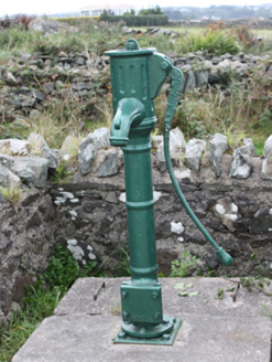 water pump1062 yd
Explorer Tom Water pump in Carrowmenagh was erected around 1890 with a cow-tail handle and a fluted spout. The inventory remembers…
 Tremone BayBeach / strand · 1117 yd
Explorer Tom Tremone Bay looks like a place where a child might spend an afternoon investigating rock pools, yet one visitor left…
 kiln1200 yd
Explorer Tom Kiln in Carrowmenagh has a round stone body and a square opening, built around 1850 for making lime. The old survey…
 Kilpatrick Burial GroundBurial ground · 1246 yd
Explorer Tom Kilpatrick Burial Ground is officially a ghost, hiding in rough rock over Tremone Bay. The records just shrug at a pile…
 Standing stone in BallycharryStanding stone · 1429 yd
Explorer Tom Standing stone in Ballycharry was only three feet tall before it got moved around 1940, which feels like a very quick…
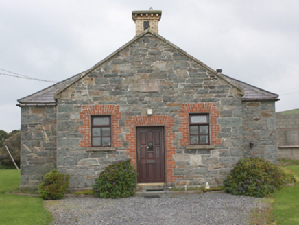 Carrowbeg National SchoolSchool · 1588 yd
Explorer Tom Carrowbeg National School's building survey found '1873' carved above the door, with the old schoolyard wall and toilet…
More historic places in County Donegal · All of County Donegal

What do you know about this place?Tap to add a comment or ask a question