What is recorded here
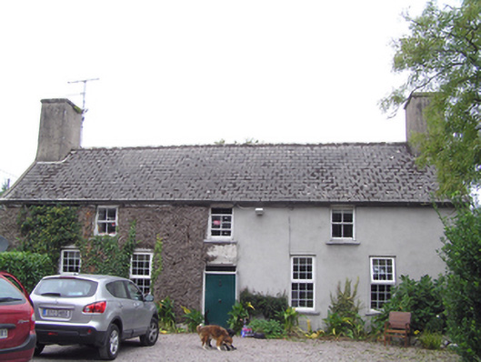
Detached five-bay two-storey house, built c. 1720, having two-bay two-storey extension to west side of rear (north) elevation, with parallel pitched slate roof forming M-profile west elevation, and being hipped at east end. Pitched artificial slate roof with rendered end chimneystacks. Rendered walls. Square-headed openings throughout, with timber sliding sash windows, two-over-two pane to first floor front and rear elevations, three-over-three pane to ground floor rear elevation, replacement uPVC windows to ground floor front elevation, replacement timber casement window to west elevation and timber battened door with plain overlight. Single-bay single-storey outbuilding attached to east gable, having pitched corrugated-iron roof, rendered walls and square-headed opening with timber battened door. Single-bay single-storey outbuilding with lean-to corrugated metal roof and rendered walls attached to rear (north) elevation. Outbuildings to west of house comprising roofless multiple-bay two-storey outbuilding with rubble stone external staircase, flanked by single-bay single-storey outbuilding with pitched corrugated-iron roof to south gable and single-bay single-storey outbuilding with pitched slate roof to north gable. Rubble stone walls and square-headed openings with dressed limestone voussoirs. Rubble stone curved entrance walls and square-profile piers with double-leaf wrought-iron gates.
Simple pleasing form created by broad elevation punctuated by small window openings. Remarkably large chimneystacks to gables give distinctive roofline and indicate an early date. Although some windows have been replaced, and possibly repositioned, it retains its form and imposing scale.
This does not grant access. Most recorded buildings are privately owned; view them only from public ground unless the owner allows entry.
Places near here
 Kilbeg Househouse · 1153 yd
 cottage orneecottage ornee · 1231 yd
 William Heffernan MemorialMemorial · 1313 yd
 Mitchell's WoodWood · 1443 yd
 Cromlech (Site of)Barrow, mound barrow · 1541 yd
 BarrowBarrow, mound barrow · 1663 yd
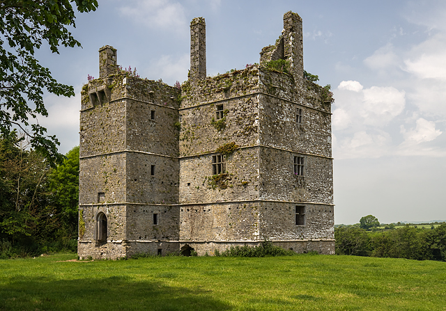 Ightermurragh Castle (in Ruins)House, fortified house · 1738 yd
 Castlemartyr CastleCastle · 1.1 mi
 Pigeon WoodWood · 1.4 mi
 N25 Picnic SitePicnic place · 2.3 mi
 Historical Graveyard InformationVisitor information · 2.7 mi
 Fainin's WellSpring · 3.3 mi
Other information
Photo: National Inventory of Architectural Heritage · Website use allowed for educational or private purposes with source credit