What is recorded here
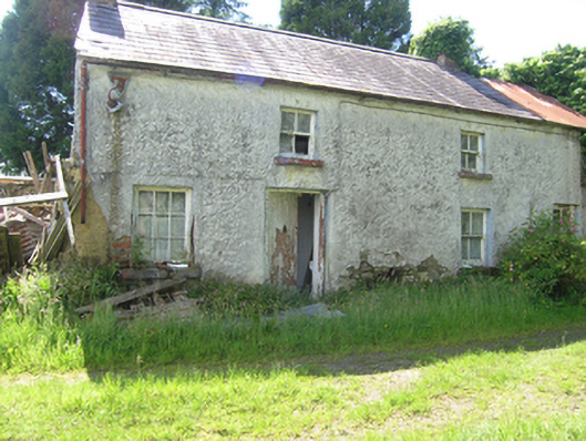
Detached two-storey four-bay vernacular house, built c.1780, with irregularly placed windows. Now vacant. Pitched slate roof, brick chimneystacks to gables, remaining of cast-iron rainwater goods. Roughcast render over fieldstone and mud walls with brick around openings. Four-over-four timber sash windows to front and rear elevation with stone sills. Nine-pane fixed window in southern bay. Timber sheeted doors. Outbuildings to south and east, overgrown and in ruinous state.
A vernacular house of particularly strong character, retaining its historic form and many interesting features, including roughcast render with lime wash finish, historic sash windows, and sheeted doors. The irregular fenestration may be an indicator that the upper level is a later addition to a traditional single-storey farmhouse. Outbuildings were once attached to the end gables forming a long linear arrangement, with further outbuildings to the west and south, subdividing the farm yard into different areas. Access to the river to the north indicates some historic relationship to it and to the clustered settlement of Kilcreeny to the north, arranged around a flax mills at Kilcreeney Bridge.
From the Buildings of Ireland (National Inventory of Architectural Heritage) record 40401723
This does not grant access. Most recorded buildings are privately owned; view them only from public ground unless the owner allows entry.
Places near here
Photo credits
- National Inventory of Architectural Heritage
- Kenneth Allen, Geograph · CC BY-SA 2.0
- Pamela Norrington, Wikimedia Commons · CC BY-SA 2.0
- D Gore, Geograph · CC BY-SA 2.0
- This file is from the Mechanical Curator collection , a set of over 1 million images scanned from out-of-copyright books and released to Flickr Commons by the British Library. View image on Flickr View all images from book View catalogue entry for book ., Wikimedia Commons · Public domain
- Eric Jones, Geograph · Creative Commons Attribution-ShareAlike 2.0
- Eric Jones, Wikimedia Commons · CC BY-SA 2.0
- Stan Courtney, Geograph · CC BY-SA 2.0
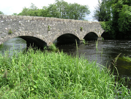 Killycreeny BridgeBridge · 75 ydCorickMountain / peak · 585 ydBawn in DrumsheilBawn · 705 ydBawn in DrumsheilBawn · 822 yd
 St Patrick's Roman Catholic ChurchChurch/chapel · 1108 yd
 Cabragh RingfortArchaeological place · 1.8 miGiant's GraveArchaeological place · 2.3 mi
 Flagpole HillMountain / peak · 3.7 mi
 Dartrey ForestForest · 4.3 mi
 Graveyard in Drumgoon (clankee By.)Graveyard · 4.3 mi
 Dawson MonumentMonument · 4.4 mi
 Carn WoodForest · 5.6 mi
More historic places in County Cavan · All of County Cavan
What do you know about this place?