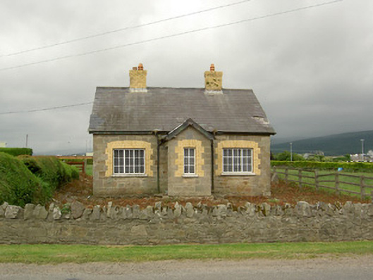
What is recorded here
Detached three-bay single-storey house, dated 1914, with porch to front. Pitched slate roof with yellow brick chimneystacks and cast-iron rainwater goods. Snecked sandstone walls with dressed quoins and having limestone date plaque to porch. Square-headed window openings having boarded windows to front elevation and…
Read the whole record
Detached three-bay single-storey house, dated 1914, with porch to front. Pitched slate roof with yellow brick chimneystacks and cast-iron rainwater goods. Snecked sandstone walls with dressed quoins and having limestone date plaque to porch. Square-headed window openings having boarded windows to front elevation and gables and timber double casement window to rear, all with with yellow brick block-and-start surrounds and limestone sills. Square-headed door opening with timber panelled door and dressed sandstone surround and voussoirs. Outbuilding to rear of house with pitched slate roof and roughly coursed rubble sandstone walls with dressed quoins. Square-headed door and window openings with timber battened doors and fixtures. Wrought-iron double-leaf gate to front of site set to dressed sandstone piers with caps, in rubble boundary wall.
The simple form of this building is enhanced by the use of different stone types and dressings in its construction. The yellow brick window surrounds contrast with the sandstone walls to create textural variation in the building's appearance, adding to its visual appeal. This house forms part of a group of cottages along this road, with their associated outbuildings.
From the Buildings of Ireland (National Inventory of Architectural Heritage) record 22208102
Places near here
Picture notes
- National Inventory of Architectural Heritage
- Algirdas at Lithuanian Wikipedia, Wikimedia Commons · Public domain
- Computer-made picture. It does not show this monument.
- Stefan Riesner, Wikimedia Commons · CC BY-SA 3.0
- Sitomon, Wikimedia Commons · CC BY-SA 2.0
- Chmouel Boudjnah Original uploader was Chmouel at fr.wikipedia, Wikimedia Commons · CC BY-SA 3.0
- Computer-made picture. It does not show this walking route.
- Mike Searle, Geograph · CC BY-SA 2.0
- Computer-made picture. It does not show this mountain top.
 Mount CarmelHouse · 205 yd
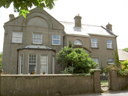 Carn BraeOfficer's house · 234 yd
 Pedunculate Oak276 yd
 Fairy fort / earthen ringfort in Carrigeen (caher Par.)Fairy fort / earthen ringfort · 730 ydComputer-made picture
 Swiss CottageHeritage attraction · 915 yd
 European Yew934 yd
 Enclosure in Kilcommon More (north)Enclosure · 1013 ydComputer-made picture
 Cahir CastleHeritage attraction · 1645 ydSiege of Cahir CastleSiege · 1.0 mi
 Tipperary Heritage WayWalking route · 1.5 miComputer-made picture
 Coolbane Castle (in ruins)Castle, tower house · 2.6 mi
 SturrakeenMountain / peak · 4.7 miComputer-made picture
More historic places in County Tipperary · All of County Tipperary

What do you know about this place?Tap to add a comment or ask a question