
What is recorded here
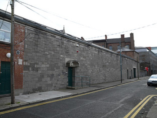
Pair of attached two-bay two-storey houses, built c.1740, front (west) facade having former archway between houses. Hipped slate roofs having granite capping to parapet. Brown brick chimneystacks having clay chimneypots. Brown brick walls laid in Flemish bond. Square-headed window openings having granite sills. Square-headed door openings having recent timber doors and overlights. All openings boarded-up. Elliptical-arched opening between houses with brick in-fill at high level.
Despite their disuse, both houses retain early fabric in the roof structure, chimneystacks and brickwork. The chimneystacks were constructed in the centre of the plan, parallel to the front elevations, and have an impressive presence to the streetscape. The central arch indicates the former presence of a lane into the centre of the block as depicted on Rocque's 1756 map of Dublin. This is similar to the arrangement with no.43 and no.44 Church Street, on the other side of this block.
This does not grant access. Most recorded buildings are privately owned; view them only from public ground unless the owner allows entry.
Places near here
 The Friaryfriary · 33 yd
 Catholic Church of Saint Mary of the Angelschurch/chapel · 66 yd
 Old Jameson DistilleryMuseum · 93 yd
 Habitation site in Unknown TownlandHabitation site · 104 yd
 Jameson ChimneyHeritage attraction · 122 yd
 Burnt mound in Unknown TownlandBurnt mound · 266 yd
 London PlaneLondon Plane · 474 yd
 Croppies Acre MemorialMemorial · 721 yd
 CastleCastle, unclassified · 783 yd
 UN Veterans MemorialMemorial · 792 yd
 European PearEuropean Pear · 810 yd
 Campus Information PointVisitor information · 875 yd
Other information
Photo: Eric Jones · CC BY-SA 2.0