What is recorded here
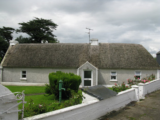
Detached five-bay single-storey thatched house built c. 1820, having recent porch to front (south-east). Later gable-fronted projecting bay to rear (north-west), having recent addition with connective corridor to side (south-west). Hipped thatched roof with rendered chimneystacks and gable coping to side (south-west). Pitched slate roof to gable-fronted bay. Roughcast rendered wall to front elevation with rendered plinth and platbands. Rendered walls elsewhere. Square-headed window openings with render surrounds, sills and replacement uPVC casement windows throughout. Square-headed door openings having uPVC doors. Two-bay single-storey outbuilding to south-east of house having pitched slate roof with rendered gable copings and white-washed rubble stone walls. Camber-headed carriage way opening with tooled limestone voussoirs and recent corrugated-iron door. Recent outbuildings to east and two-bay single-storey barrel-vaulted outbuilding to north. Located within own grounds, having rendered rubble stone enclosing walls with square and rectangular profile piers having rendered and rubble stone coping supporting single and double-leaf wrought-iron gates.
Constructed in the early nineteenth century, this attractive thatched house is an important part of a group of traditional thatched houses located within south County Limerick. Despite some renovations, much of the building's historic form and fabric still survives including its traditional thatching, battered walls and modestly scaled chimneystacks. Thatched houses such as this one were once a common feature within the Irish landscape, but are now becoming an increasingly rare feature of the rural landscape. The retention of white-washed rubble stone outbuildings complement the historic character of this historic property.
This does not grant access. Most recorded buildings are privately owned; view them only from public ground unless the owner allows entry.
Places near here
 Moated site in AhaveheenMoated site · 1213 yd
 Fairy fort / earthen ringfort in AhaveheenFairy fort / earthen ringfort · 1301 yd
 ToberhoranSpring · 1313 yd
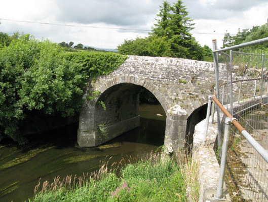 Broken Bridgebridge · 1418 yd
 CastleCastle, unclassified · 1.5 mi
 Garbally WellSpring · 1.6 mi
 Church (in ruins)Church · 1.6 mi
 Mayne Ho.Castle, unclassified · 1.8 mi
 National Co-op MuseumMuseum · 3.6 mi
 Ballagh MountainMountain / peak · 6.9 mi
 Mullaghareirk - Banane LoopWalking route · 7.7 mi
 Rock HillMountain / peak · 9.7 mi
Other information
Photo: National Inventory of Architectural Heritage · Website use allowed for educational or private purposes with source credit