DDiscover AloneMapAbout

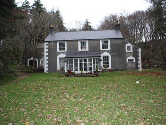
House in Ballintlieve

House
House in Ballintlieve
Photo: National Inventory of Architectural Heritage · Report the wrong picture

What is recorded here

Detached three-bay two-storey house, subsequently in use as a constabulary barracks, dated 1820, with double gabled two-storey return to rear, single-bay two-storey lean-to to south-east gable, single-storey flat-roofed block with crenellated parapet to north-west gable and modern sun room to front, now in use as…

Read the whole record
Detached three-bay two-storey house, subsequently in use as a constabulary barracks, dated 1820, with double gabled two-storey return to rear, single-bay two-storey lean-to to south-east gable, single-storey flat-roofed block with crenellated parapet to north-west gable and modern sun room to front, now in use as house. Pitched slate roof to main house with clayware ridge tiles, smooth rendered chimneystacks with rendered cornice coping and polygonal terracotta pots to gables, replacement rainwater goods. Smooth rendered ruled-and-lined walls with smooth rendered block-and-start quoins. Square-headed window openings with smooth rendered ogee surrounds with six-over-six, six-over-three, three-over-three, two-over-two and one-over-one pane timber sliding sash windows, timber lattice casement windows to rear, all with stone sills. Square-headed door opening with smooth rendered surrounds and battened timber door with metal studs, glazed with latticework window; square-headed door opening with smooth rendered ogee surrounds and timber panelled door with metal studs; pointed-arch headed door opening to rear with smooth rendered surrounds and matchboard timber door with metal studs, approached by rendered steps flanked by smooth rendered splayed strings with decorative cast-iron handrail. Set within own grounds with garden to front and multiple-bay two-storey outbuilding to rear, with pitched slate roof, roughcast rendered chimneystack with cornice coping and replacement rainwater goods. Roughcast rendered walls. Square-headed window openings with smooth rendered ogee surrounds and latticework casement windows. Square-headed door openings with smooth rendered ogee surrounds and matchboard timber doors.
A fine house that once served as a constabulary barracks, although it was most likely originally built as a private dwelling. Its eclectic neo-medieval detailing of ogee surrounds, crenellated parapet and studded doors make it a particularly unusual property. The house is shown on the Ordnance Survey first edition six-inch map of c. 1837 here it is named as 'Mintiaghs'. On the Ordnance Survey twenty-five inch map of c. 1905 it is named as 'Mintiaghs Constabulary Barrack'. The well maintained outbuilding, of similar quality and architectural detailing, enhances its significance, making the property an important asset to the architectural heritage of the area.

From the Buildings of Ireland (National Inventory of Architectural Heritage) record 40901913

This does not grant access. Most recorded buildings are privately owned; view them only from public ground unless the owner allows entry.

What do you know about this place?Tap to add a comment or ask a question

What you write will be public.

Places near here

Photo credits
  • National Inventory of Architectural Heritage
  • David Dixon, Geograph · CC BY-SA 2.0
  • Picture: Glendowen
  • Michael Murtagh, Geograph · CC BY-SA 2.0
  • Colin Park, Geograph · CC BY-SA 2.0
  • Richard Webb, Wikimedia Commons · CC BY-SA 2.0
  • Wanfried-Dublin, Wikimedia Commons · CC BY-SA 4.0
  • Andreas F. Borchert, Wikimedia Commons · CC BY-SA 4.0
  • Dr Neil Clifton, Geograph · CC BY-SA 2.0
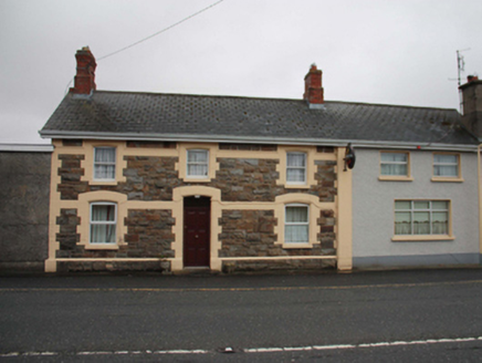
North PoleRailway station · 1.0 mi

Explorer Tom North Pole station opened in 1901 as part of the narrow-gauge railway to Carndonagh, and now serves pints instead of…

The North PolePub · 1.0 mi

Explorer Tom The North Pole in Drumfree is geographically chaotic, claiming polar status while sitting in the middle of Donegal’s…
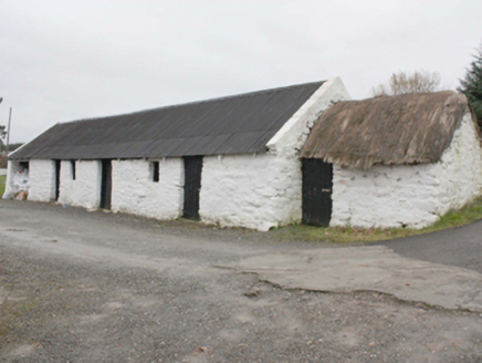
outbuilding1.5 mi

Explorer Tom Outbuilding in Owenboy is a modest c. 1820 shed that’s somehow managed to keep its rope-and-peg thatch alive. It’s not…

Glendowen craft shopVisitor attraction · 1.6 mi

Explorer Tom Glendowen craft shop in County Donegal is right next to the ditch where a poet fell and wrote his masterwork while…

BulbinMountain / peak · 2.0 mi

Explorer Tom Bulbin has a monument from 1933 that’s taller than most humans, which makes for some very awkward photo opportunities…

Wee Slieve SnaghtMountain / peak · 2.4 mi

Explorer Tom Wee Slieve Snaght in County Donegal is a bit of a shy one, hiding its trig point inside a circular enclosure until…

Slieve MainMountain / peak · 2.5 mi

Explorer Tom Slieve Main is recorded as a mountain / peak in County Donegal, and it looks like a solid, reliable sort of hill. I…

Slieve SnaghtMountain / peak · 2.6 mi

Explorer Tom Slieve Snaght has a namesake in Donegal, so I checked the map twice before announcing that I had found the snow…

Ballyannan Portal TombPortal tomb · 3.3 mi

Explorer Tom Ballyannan Portal Tomb is perched on Aghaweel Hill, offering a sprawling view across Lough Swilly to the Fanad…
Clonmany Early Church GraveyardGraveyard · 3.9 mi

Explorer Tom Clonmany Early Church Graveyard hides a stone with two cupmarks called St. Colmcille's knee-prints. I reckon a kneeling…

Clonmany ChurchChurch · 3.9 mi

Explorer Tom Clonmany Church was built in 1772, but a 1690 map puts a church and a castle in the surrounding area. The later church…

Ballyliffin HotelHotel · 4.7 mi

Explorer Tom Ballyliffin Hotel number one is probably the quiet one next to the church, hiding a love story that went badly wrong.…

More historic places in County Donegal · All of County Donegal

Add to this placeAdd a picture Add a detailed tip Add a story

Explore the map1,095,414 places to discover

Next place · or swipeNorth Pole