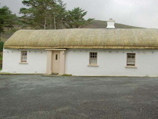
What is recorded here
Detached four-bay single-storey vernacular house, built c. 1860, having flat-roofed windbreak porch to main elevation (north-east) and single-storey flat-roofed extension to the rear (south-west). Pitched/domed rope-and-stone peg straw thatch having smooth rendered chimneystack (offset to the north-west side of…
Read the whole record
From the Buildings of Ireland (National Inventory of Architectural Heritage) record 40909009
Places near here
Photo credits
- National Inventory of Architectural Heritage
- Maker not stated on source page, www.pinterest.com
- Maker not stated on source page, en.wikipedia.org
- Maker not stated on source page, tr.pinterest.com
- Sarah Murphy, Wikimedia Commons · CC BY-SA 4.0
- Kenneth Allen, Geograph · CC BY-SA 2.0
- P L Chadwick, Geograph · CC BY-SA 2.0
- Michael Earnshaw, Geograph · CC BY-SA 2.0
- Michael Murtagh, Geograph · CC BY-SA 2.0
- Dennis Reynolds, Geograph · CC BY-SA 2.0
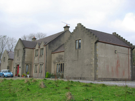 Carrick LodgeCountry house, hunting/fishing lodge · 1238 yd
Explorer Tom Carrick Lodge is throwing up its crow-stepped parapets at you like it’s trying to catch your eye from across the…
 Standing stone in An Charraig ÍochtarachStanding stone · 1365 yd
Explorer Tom Standing stone in An Charraig Íochtarach has plough marks on it, which is wild for a rock that stood up straight. I bet…
 Inscribed stone in Sliabh Leirg An DachtáinInscribed stone · 1.1 mi
Explorer Tom Inscribed stone in Sliabh Leirg An Dachtáin is broken into two pieces, with the top half lying in a stream. Locals call…
 Droichead an Charraig ÍochtarachBridge · 1.3 mi
Explorer Tom Droichead an Charraig Íochtarach stands near where the Owenwee meets Teelin Bay, its tall round-headed arch looking…
 Holy WellsHoly well · 1.3 mi
Explorer Tom Holy Wells at An Seanbhaile includes a natural spring recorded southeast of Hugh MacBrick's church, without a surviving…
 Mapped graveyardGraveyard · 1.3 mi
Explorer Tom County Donegal (Graveyard) is currently involved in a massive dispute with a fairy about who has parking rights on the…
 Hugh Mac Bricks Church (in Ruins)Church · 1.3 mi
Explorer Tom Hugh Mac Bricks Church sits on a narrow ridge where the ruins are in a parlous condition. The name suggests he was a…
 Óstán Sliabh LiagHotel · 1.4 mi
Explorer Tom Óstán Sliabh Liag is perched on Glen Road, on a mountain that hates you for no specific reason. Its rules say you must…
 John the miner'sPub · 1.4 mi
Explorer Tom John the miner’s in Carrick sounds like he dug up more than coal. It was previously just known as Central Bar, so keep…
 Slieve League se TopMountain / peak · 1.5 mi
Explorer Tom Slieve League SE Top is recorded as a mountain / peak in County Donegal, featuring an almost flat summit area. It leads…
 Slieve LeagueMountain / peak · 1.8 mi
Explorer Tom Sliabh Liag rises so abruptly from the Atlantic that even Donegal seems to stop and look at its own handiwork. I…
 CroaghstraleelMountain / peak · 2.4 mi
Explorer Tom Croaghstraleel in County Donegal is having a massive go at the council, claiming they’ve left its name half-spelled and…
More historic places in County Donegal · All of County Donegal

What do you know about this place?Tap to add a comment or ask a question