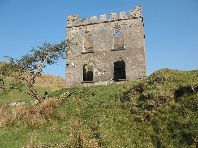
What is recorded here
Detached two-bay two-storey house, built c.1850. Now roofless, having rendered rubble stone crenellated parapets above stone string course. Rendered rubble stone walls. Square-headed openings, lacking fittings, with doorway to east elevation. Ruins of rubble stone structures to southeast. Building stands in isolated…
Read the whole record
From the Buildings of Ireland (National Inventory of Architectural Heritage) record 40903409
Places near here
Photo credits
- Colin Park, Wikimedia Commons · CC BY-SA 2.0
- Matthew Chadwick, Geograph · CC BY-SA 2.0
- Anne Burgess, Geograph · CC BY-SA 2.0
- John Martin, Geograph · CC BY-SA 2.0
- Kenneth Allen, Geograph · CC BY-SA 2.0
- Rod Grealish, Geograph · CC BY-SA 2.0
- Joseph Mischyshyn, Geograph · CC BY-SA 2.0
- Eric in SF, Wikimedia Commons · CC BY-SA 3.0
- Maker named on the Wikimedia Commons picture page · Public domain
- Rossographer, Wikimedia Commons · CC BY-SA 2.0
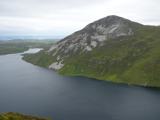 Aghla MoreMountain / peak · 1495 yd
Explorer Tom Aghla More is part of a local group called the Seven Sisters. I have to ask if they ever get bored of each other, or if that is just what mountains do when they stand close enough to gossip.
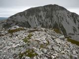 MackoghtMountain / peak · 1.1 mi
Explorer Tom Right then, we’ve reached the summit of Mackoght in County Donegal. I can already see the mighty Errigal looming right behind us, which is quite the dramatic backdrop for a cheeky selfie.
 Dunlewy Church (Tullaghobegly)Church/chapel · 2.7 mi
Explorer Tom Dunlewy Church (Tullaghobegly) has a roofless nave overlooking the lough. I picture James Russell lying flat on his back, staring up at the sky where the ceiling used to be.
 Dunlewey Church of IrelandRuins · 2.7 mi
Explorer Tom Dunlewey Church of Ireland is mostly built of pure white marble, yet it currently looks grubby. I am baffled by how much lichen it takes to ruin such a pristine material.
 Errigal Youth HostelHostel · 3.0 mi
Explorer Tom Errigal Youth Hostel in County Donegal is where dreams go to get squished under mattresses. It's cozy if you define cozy as 'crowded' and 'slightly damp'.
 McGeady's BarPub · 3.1 mi
Explorer Tom McGeady’s is sitting there looking suspiciously quiet. Order something strong and ask if they’ve had any ghosts; if not, blame the damp on them instead.
 Astelleen Burn WaterfallWaterfall · 3.4 mi
Explorer Tom Astelleen Burn Waterfall, meaning torrent or flood, sloping down three kilometers southwest of Glenveagh Castle is a hidden gem.
 The Bridge of TearsMemorial · 3.6 mi
Explorer Tom The Bridge of Tears carried more than traffic through Muckish Gap. Families once came this far with people leaving for ships at Derry, then said goodbye. The Irish words on a stone beside the bridge remember that parting. I would stop for the story, but keep clear of the road.
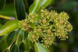 Wheel tree4.3 mi
Explorer Tom A curious Wheel tree in County Donegal offers a unique shape, so check if permission is required.
 English holly4.3 mi
Explorer Tom An English holly stands in County Donegal, its glossy leaves and bright berries adding a touch of winter color to the landscape.
 Muckish Mountain CairnCairn, unclassified · 4.7 mi
Explorer Tom Muckish Mountain Cairn is a 22-metre stone pile that practically shouts for attention from the mountain's lower edge. It’s got ruined walls trailing off into the mist, hiding whatever secrets it guards on top. I’d bet good money there’s more buried under those loose rocks than just wind and rain.
 CairnCairn, unclassified · 4.8 mi
Explorer Tom The cairn on top of Muckish Mountain was recorded as a flat-topped pile about eight metres across and 1.5 metres high. The survey says it may be of recent origin, but does not name its makers or its purpose. Even the mountain-top pile has managed to keep that bit to itself.
More historic places in County Donegal · All of County Donegal

What do you know about this place?Tap to add a comment or ask a question