DDiscover AloneMapAbout

Hotel in Rathmelton

Hotel
Hotel in Rathmelton
Photo: National Inventory of Architectural Heritage · Report the wrong picture

This does not grant access. Most recorded buildings are privately owned; view them only from public ground unless the owner allows entry.

What do you know about this place?Tap to add a comment or ask a question

What you write will be public.

What is recorded here

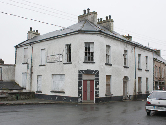
Corner-sited two-storey former hotel on L-shaped plan, built c. 1820 and altered c. 1900, having four-bay south-east elevation, single-bay chamfered corner to the south-west, and three-bay over basement elevation to the north-west. Formerly main block to south-east was two separate dwellings (Griffith’s Valuation c.…

Read the whole record
Corner-sited two-storey former hotel on L-shaped plan, built c. 1820 and altered c. 1900, having four-bay south-east elevation, single-bay chamfered corner to the south-west, and three-bay over basement elevation to the north-west. Formerly main block to south-east was two separate dwellings (Griffith’s Valuation c. 1860), later amalgamated to form a single property (by c. 1904 Ordnance Survey twenty-five inch map). Possibly containing earlier fabric (to the rear). Now out of use and derelict. Pitched natural slate roof, hipped to corner over canted corner, having skylights to the front elevations, blue-black clay ridge tiles, rendered chimneystacks with octagonal black clay pots, rendered eave course, and with some surviving sections of cast-iron rainwater goods. Roughcast rendered walls over projecting smooth rendered plinth course, and with smooth rendered block quoins to the north-west and south-east corners of main building. Hand-painted signboard to west elevation, and remains of metal signage to west elevation. Square-headed window openings having smooth rendered reveals, mainly painted stone sills, and with the remains of mainly six-over-six pane timber sliding sash windows; window openings at ground floor level and to the west elevation now boarded. Square-headed doorway to chamfered corner to the south-west having battened timber double-leaf door overlight (now boarded), plinth blocks to base, and having channelled smooth rendered surround with projecting rendered keystone motif. Segmental-headed doorway to the south-east elevation, now boarded, having smooth rendered surround, plinth blocks to base, timber door, moulded timber lintel, and with blocked fanlight with remains of radial glazing bars. Segmental-headed door opening at basement level to the north-west elevation, now boarded, having timber panelled double-doors with bolection mouldings, smooth rendered reveals, and having flight of rendered stone steps leading down; stairway flanked to the south by rubble stone retaining wall having concrete coping over, with remains of cast-iron post box, c. 1890, to the south elevation, with raised VR Royal cipher, letter flap with raised lettering ‘POST OFFICE’, and with cast-iron door now removed. Road-fronted to the south-east elevation on Castle Street with west\north-west elevation fronting onto Market Cross with open space. Attached complex of two-storey over basement buildings (formerly a dwelling, later modified and amalgamated into hotel) to the north-west, now derelict, comprising two-bay two-storey block adjoining main building with single-bay two-storey over basement gable-fronted block to the west with former shopfront. Single-storey block attached to the south end of two-storey building to the east. Hipped and pitched natural slate roof to gable-fronted bay having rendered eaves course brought around front (south) as stringcourse, and with rendered brick chimneystack to the west pitch; roughcast rendered walls (brick construction exposed to the west elevation); square-headed openings (now blocked); and remains of modern shopfront to the south. Remains of pitched natural slate roof to adjoining block; roughcast rendered walls, and square-headed openings (now blocked).
Although now derelict and out of use, this former hotel retains much of its early form and character. Its visual appeal and integrity are enhanced by the retention of salient fabric such as the natural slate roof, battened timber doors, and the remains of timber sliding sash windows, albeit in a dilapidated condition. The canted\chamfered corner to the south-west of the main building is an interesting feature that gives this building a strong presence in the streetscape. The stucco surround to the doorway to this canted\chamfered corner, and the doorway to the Castle Street with remains of radial fanlight, add some muted decorative interest to this otherwise relatively plain structure. The main body of the building to the south-east aligning Castle Street appears to date to the first half of the nineteenth century, perhaps built c. 1820. It is apparently built on the site (and possibly incorporates the fabric from) an earlier coaching inn that dated to the mid-eighteenth century at the latest. This earlier inn serviced passengers on the mail coaches to and from Dublin. The main body of the building is indicated as two separate houses on the Griffith Valuation map of c. 1860; these buildings were in single ownership and modified for use as a hotel by c. 1904 (Ordnance Survey twenty-five inch map sheet). The two-storey over basement block to the north-west was in existence by c. 1834 (Ordnance Survey first edition six-inch map sheet). This block was probably originally built as a private dwelling(s) but may have a connection with a shambles (collection of small shops) that lay adjacent to the north (Ordnance Survey first edition map; still in existence in 1904). Sensitively restored, this former hotel and ancillary structures would make a strongly positive contribution to the streetscape to the centre of the original seventeenth century Plantation-era heart of Ramelton. It is an integral element of the built heritage of the town, and an important element of the social history of Ramelton as a former hotel in this once thriving port and market town.

From the Buildings of Ireland (National Inventory of Architectural Heritage) record 40823061

Places near here

Photo credits
  • National Inventory of Architectural Heritage
  • Kenneth Allen, Geograph · Creative Commons Attribution-ShareAlike 2.0
  • Willie Duffin, Geograph · CC BY-SA 2.0
  • Kenneth Allen, Wikimedia Commons · CC BY-SA 2.0
  • Maker not stated on source page, www.pinterest.com
  • Maker not stated on source page, br.pinterest.com
  • Malene Thyssen, Wikimedia Commons · CC BY-SA 3.0
  • Picture: Donegal Day Out
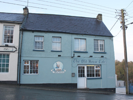
The Old House CaféHouse · 34 yd

Explorer Tom The Old House Café might be hiding a secret 1619 timber beam inside its walls. I bet it’s been quietly judging everyone…
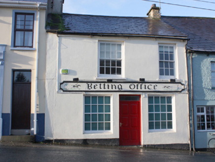
Betting OfficeHouse · 40 yd

Explorer Tom House in Rathmelton started because two lads made a bet in the pub about who could build the most interesting shop at…

outbuilding97 yd

Explorer Tom Outbuilding in Rathmelton wears red brick trim on its stone face, like a farmer who forgot to take off his city suit. I…

First Ramelton Presbyterian ChurchChurch/chapel · 105 yd

Explorer Tom First Ramelton Presbyterian Church was built between 1905 and 1907 with red sandstone trim that really pops against the…
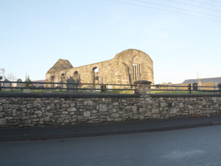
Tullyaughnish Church of Ireland ChurchChurch/chapel · 145 yd

Explorer Tom Tullyaughnish Church of Ireland Church has a chunk of wall from an island church sitting right above its window. I…

Tullyaughnish Old ChurchChurch · 148 yd

Explorer Tom Tullyaughnish Old Church carries a carved stone from Aughnish island: a stylised tree between two lion-like creatures…

store/warehouse151 yd

Explorer Tom Rathmelton warehouse is standing guard over the quayside like a stone giant who forgot what to do with its hands. Saint…
Tullyaughnish Old Church GraveyardGraveyard · 153 yd

Explorer Tom Tullyaughnish Old Church Graveyard has been hanging around since 1622, which is basically forever in church years. Sir…

Rathmelton CastleCastle, unclassified · 256 yd

Explorer Tom Rathmelton Castle was a three-and-a-half-storey beast with round turrets, built by Sir William Stewart before the 1641…

Mapped graveyardGraveyard · 298 yd

Explorer Tom This mapped graveyard had a fox take charge for a whole week before anyone noticed, and now the locals treat him like…
European Beech752 yd

Explorer Tom European Beech in County Donegal would complain to the council about the lack of shade during peak afternoon hours and…

Drummonaghan WoodForest recreation place · 1334 yd

Explorer Tom Drummonaghan Wood is only about a kilometre from Ramelton, yet its trees make the busy old town feel a thoughtful…

More historic places in County Donegal · All of County Donegal

Add to this placeAdd a picture Add a detailed tip Add a story

Explore the map1,095,414 places to discover

Next place · or swipeThe Old House Café