What is recorded here
From OpenStreetMap (© OpenStreetMap contributors) n3186695293
Places near here
Photo credits
- Joseph Mischyshyn, Wikimedia Commons · CC BY-SA 2.0
- Maker not stated on source page, www.donegaldaily.com
- Maker not stated on source page, www.govisitinishowen.com
- Maker not stated on source page, www.youtube.com
- Maker not stated on source page, www.pinterest.com
- Robert Bone, Wikimedia Commons
- National Inventory of Architectural Heritage
- Maker not stated on source page, ru.pinterest.com
- Maker not stated on source page, readymap.irish
- P L Chadwick, Geograph · CC BY-SA 2.0
- Kmcnamee, Wikimedia Commons · CC BY-SA 4.0
 Inis Mhic an DoirnIsland · 753 yd
Explorer Tom Rutland Island was once pitched as the next big fishing town, and I would have invested every imaginary penny in it.…
 Oileán na LachanIslet · 1203 yd
Explorer Tom Oileán na Lachan is in a bitter feud with the next village over who has the ugliest ducks, which honestly doesn't seem…
 Eadar InisIslet · 1203 yd
Explorer Tom Eadar Inis is having a massive row with the nearest tree about who gets to cast the shadow first at sunset. The drama…
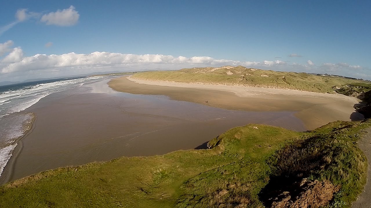 An Trá DheargBeach / strand · 1718 yd
Explorer Tom An Trá Dhearg means Red Strand in Irish, which map makers probably thought was a nice touch until they realized how…
 Bottom beachBeach / strand · 1.1 mi
Explorer Tom Bottom beach in County Donegal got its name because the map makers were too tired to come up with anything more…
 Burtonport Loops - Lúb Cheann Bhaile CruaicheOfficial walking route · 1.2 mi
Explorer Tom Burtonport's Lúb Cheann Bhaile Cruaiche starts by the harbour and borrows an old railway line for a glorious Donegal…
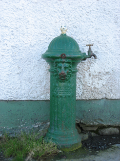 water pump1.2 mi
Explorer Tom Water pump in Burtonport, installed c.1890, features a lion's-head spout that looks like it is roaring at the ferry…
 Mapped cemeteryCemetery · 1.2 mi
Explorer Tom Mapped cemetery complains to the council about how the grass is always too short on the left side because it likes…
 Harbour Front CafeCafé · 1.2 mi
Explorer Tom Harbour Front Cafe in County Donegal is planning its early retirement by serving soggy rolls and dramatic fog to anyone…
 O’Donnell’sPub · 1.2 mi
Explorer Tom O’Donnell’s in Burtonport is called Jimmy Johnny’s by locals, which proves names change faster than tides. It would…
 Gairmscoil McDiarmada, Arranmore GAAGAA ground · 1.3 mi
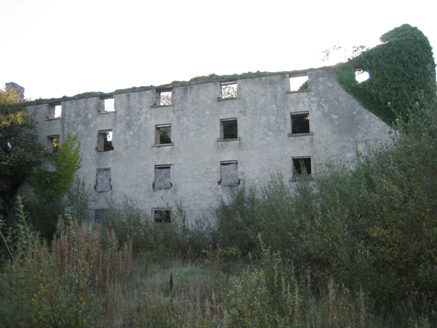 store/warehouse1.3 mi
Explorer Tom Store or warehouse in Burtonport was built around 1850, perhaps using older walls from about 1780. The survey found its…
More cliffs, bays and coast in County Donegal · All of County Donegal

What do you know about this place?Tap to add a comment or ask a question