What is recorded here
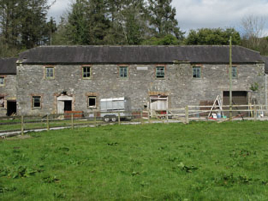
U-plan farmyard complex, built c.1840, comprising six-bay single-storey block flanked by four-bay two-storey blocks, in turn flanked by single-storey blocks, which extend perpendicularly to create U-plan. Eastern two-storey block in use as house, having gabled porch. Pitched and hipped slate roofs with cast-iron rainwater goods. Rendered chimneystacks to dwelling. Rubble limestone walls with quoins. Square-headed openings with red brick block-and-start surrounds, two-over-two timber sliding sash windows and replacement timber and uPVC windows. Square-headed, segmental-headed and round-headed door openings, retaining timber battened door to central block. Random rubble limestone boundary walls to south with entrance to south-west, comprising cut limestone piers and coping with cast-iron gate.
An impressive and substantial courtyard of outbuildings which has a dominating presence. This largely intact attractive complex demonstrates coherent and symmetrical design, and retains much of its historic fabric.
This does not grant access. Most recorded buildings are privately owned; view them only from public ground unless the owner allows entry.
Places near here
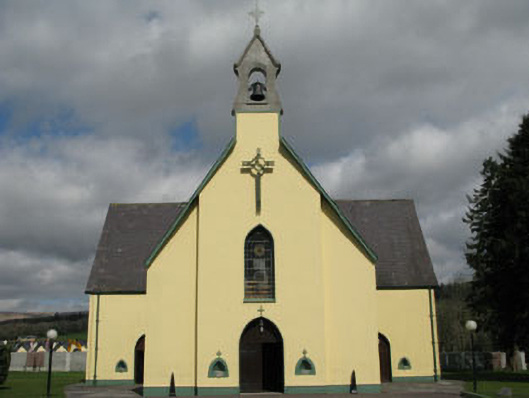 Séipéal Ghobnatan [Saint Gobnait's Catholic Church]church/chapel · 557 yd
 Holy WellHoly well · 618 yd
 Ballyvourney Bridgebridge · 915 yd
 Kealaboane WoodWood · 947 yd
 CairnCairn, unclassified · 994 yd
 Castle (Site of)Castle, unclassified · 1108 yd
 Cascade WoodWood · 1372 yd
 CastleCastle, unclassified · 1.7 mi
 KnockullaneMountain / peak · 1.8 mi
 Cnoc na nUlánMountain / peak · 1.8 mi
 European long distance path E8 - part IrelandWalking route · 2.3 mi
 Sli Gaeltacht MuscraiWalking route · 4.2 mi
Other information
Photo: National Inventory of Architectural Heritage · Website use allowed for educational or private purposes with source credit