
Places near here
Photo credits
- Wikimedia Commons contributor shown on the public file page · Public domain
- National Inventory of Architectural Heritage
- William Frederick Wakeman (1822-1900), Wikimedia Commons · Public domain
- Kenneth Allen, Geograph · Creative Commons Attribution-ShareAlike 2.0
- Andreas F. Borchert, Wikimedia Commons · CC BY-SA 4.0
- Andreas F. Borchert, Wikimedia Commons · CC BY-SA 3.0 de
- Kenneth Allen, Geograph · CC BY-SA 2.0
- louise price, Geograph · CC BY-SA 2.0
- D Gore, Geograph · CC BY-SA 2.0
- Pauloquicoli, Wikimedia Commons
 BarnesmoreMountain / peak · 4.0 mi
Explorer Tom Barnesmore has been carrying the wrong name tag. Mountaineering Ireland calls this summit Croaghonagh and says…
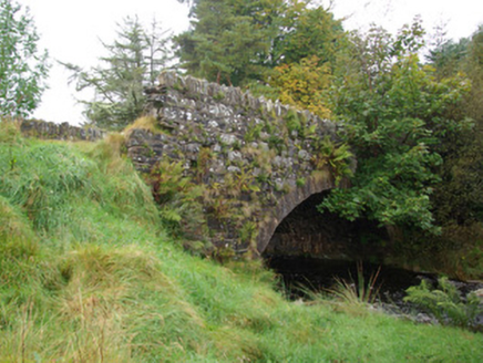 bridge4.2 mi
Explorer Tom Bridge in Croaghonagh has dressed stone voussoirs so fancy they’re basically wearing a tuxedo to a muddy field party…
 Saints IslandIsland · 4.2 mi
Explorer Tom Saints Island sounds like the place to land for the Lough Derg pilgrimage, but that is Station Island next door. This…
 Holy well: tober davagh in CrighdenisHoly Well: Tober Davagh · 4.3 mi
Explorer Tom Holy well: tober davagh in Crighdenis is allegedly best friends with a very chatty heron that squawks at anyone who…
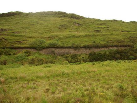 viaduct, bridge, embankment4.4 mi
Explorer Tom Viaduct, Bridge, Embankment in Keadew Upper marks the old railway route into the Barnesmore Gap. The line opened…
 St Patrick's CrossCross · 4.6 mi
Explorer Tom St Patrick's Cross on Station Island is a 1.3m shaft wrapped in spiralling bands that look like ancient rope. It’s said…
 Station IslandIsland · 4.6 mi
Explorer Tom Station Island sits in Donegal's Lough Derg with a purpose that deserves a different kind of visit from a beach or a…
 Patrick the PilgrimMemorial · 4.8 mi
Explorer Tom Patrick the Pilgrim stands there judging your life choices while St. Patrick’s Purgatory looms in the background like a…
 Benson's HillMountain / peak · 6.3 mi
Explorer Tom Benson's Hill in County Donegal took approximately four hundred cups of tea to build, according to local legend. They…
 Harvey’s PointHotel · 7.3 mi
Explorer Tom Harvey’s Point has manicured lawns running straight down to the water, which sounds like a slippery slope for anyone in…
 Ard na Mona WoodOfficial walking route · 7.6 mi
Explorer Tom Ard na Mona Wood is the sort of Donegal place that makes a short walk feel far bigger than its distance: old oak…
 Ardnamona Nature ReserveNational nature reserve · 7.9 mi
Explorer Tom Ardnamona Nature Reserve is the sort of oak wood that makes you lower your voice without anyone posting a sign asking…
More walking routes in County Tyrone · All of County Tyrone

What do you know about this place?Tap to add a comment or ask a question