
What is recorded here
The 'Holy Well' marked on the OS 6-inch maps seems to be represented by a small circle of stones 1m in diameter.
The above description was derived from the 'Archaeological Survey of County Donegal. A description of the field antiquities of the County from the Mesolithic Period to the 17th century.' Compiled by: Brian Lacey with Eamon Cody, Claire Cotter, Judy Cuppage, Noel Dunne, Vincent Hurley, Celie O'Rahilly, Paul Walsh and Seán Ó Nualláin (Lifford: Donegal County Council, 1983). In certain instances the entries have been revised and updated.
Date of upload: 22 September 2008
Linked to an unspecified saint or local tradition, the well may have been used for healing or purification rituals, as was common with many holy wells in Ireland. The small stone circle suggests a site of devotional practice, though specific folklore or historical records for Loughros Glebe are not well documented.
The monument record does not grant public access. Check the route and ask the landowner before entering private land.
- What survives
- Recorded monument
Places near here
 Holy well in Loughros GlebeHoly well · 147 yd
 graveyard/cemeterygraveyard/cemetery · 1201 yd
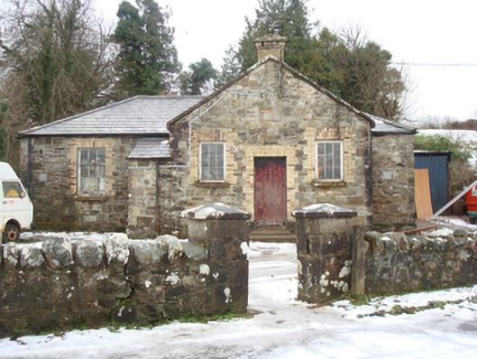 schoolschool · 1.3 mi
 Glentidaly Double Stone RingfortFairy fort / stone ringfort · 1.5 mi
 Drummonaghan WoodForest recreation place · 2.6 mi
 Bawn in RathmeltonBawn · 2.6 mi
 European BeechEuropean Beech · 2.7 mi
 Tullyaughnish Old Church GraveyardGraveyard · 2.8 mi
 Rough IslandIslet · 3.4 mi
 Croaghan HillMountain / peak · 4.0 mi
 Cranberry IslandIslet · 4.3 mi
 Fort Stewart in RuinsBawn · 4.9 mi
Other information
Photo: Credit not shown in the picture search · Rights wording not checked; contact us if this picture should be removed