
What is recorded here
Marked as a 'Holy Well', on the 2nd and 3rd editions of the OS 6-inch maps. There are now no special features, or traditions, associated with it. It is located on good land. The above description was derived from the 'Archaeological Survey of County Donegal. A description of the field antiquities of the County from…
Read the whole record
From the National Monuments Service (Archaeological Survey of Ireland) record DG053-017
Places near here
Photo credits
- Maker not stated on source page, tr.pinterest.com
- Maker not stated on source page, uk.pinterest.com
- DAYVEHUSE, Wikimedia Commons · CC BY-SA 4.0
- Maker not stated on source page, www.govisitdonegal.com
- Kenneth Allen, Wikimedia Commons · CC BY-SA 2.0
- Willie Duffin, Wikimedia Commons
- Maker not stated on source page, www.airbnb.co.za
- National Inventory of Architectural Heritage
- Humphrey Bolton, Wikimedia Commons
 Rock art in Castlebane (castlewray Ed)Rock art · 474 yd
Explorer Tom Rock art in Castlebane hides seven cupmarks on a boulder that is actually part of the wall itself. It’s like finding a…
 Standing stone in Carnamogagh LowerStanding stone · 646 yd
Explorer Tom Standing stone in Carnamogagh Lower has a family tree that’s mostly made up of guesswork and good vibes. I reckon its…
 Kiltoy Church of Ireland ChurchChurch/chapel · 674 yd
Explorer Tom Kiltoy Church of Ireland Church in Kiltoy is being picked on by the wind because its slate-hung gable end looks like…
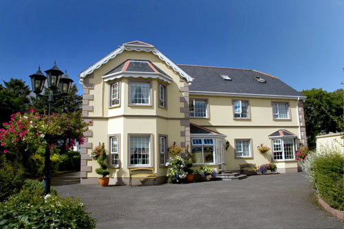 Ballyraine GuesthouseGuesthouse · 1031 yd
Explorer Tom Ballyraine Guesthouse is on Ramelton Road, which sounds like a place where you get lost easily and end up arguing with…
 Church of the Irish MartyrsChurch/chapel · 1055 yd
Explorer Tom Church of the Irish Martyrs in Letterkenny has a roof lantern up top and bronze fish beside the font. It opened in 1994…
 Tropical WorldZoo or wildlife park · 1070 yd
Explorer Tom Tropical World near Letterkenny offers a fine trick on a grey Donegal day: step into a butterfly house and find…
 Battle of FarsetmoreBattle · 1142 yd
Explorer Tom Battle of Farsetmore in County Donegal is where Hugh O'Donnell kicked Shane O'Neill's backside into the River Swilly.…
Battlefield in Ballyboe Lisenan,ballyraine,farsetmore,gortlee,kiltoy,magheranan,glebe (castlewray Ed)Battlefield · 1142 ydExplorer Tom Battlefield in Ballyboe Lisenan claims a fake king visited to inspect the troops but got lost in the mud and never came…
 Glencairn HouseGuesthouse · 1312 yd
Explorer Tom Glencairn House is a guesthouse where the ghosts refuse to check out, probably because the Wi-Fi is bad. A cow once…
 Gortlee Presbyterian ChurchChurch/chapel · 1362 yd
Explorer Tom Gortlee Presbyterian Church was built in 1785 and remodelled in 1904, but it’s now out of use. The simple hall-type…
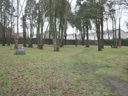 St. Conal's Psychiatric HospitalGraveyard/cemetery · 1409 yd
Explorer Tom St. Conal's Psychiatric Hospital graveyard holds a modern stone that simply says 'May they rest in peace' among so many…
 Bernard McGlinchey Town ParkPark · 1738 yd
Explorer Tom Bernard McGlinchey Town Park gives Letterkenny a generous patch of breathing room right beside the bustle, and it is…
More archaeology and monuments in County Donegal · All of County Donegal

What do you know about this place?Tap to add a comment or ask a question