
What is recorded here
Excavation licence number 02E0202. Monitoring was carried out at the IDA Business and Technology Park, Lisnenan, Letterkenny, from 12 to 25 March 2002. Phase 1 of the development comprises the building of distributor roads and services. The site comprised pasture fields with frequent rock outcrops on a south-facing…
Read the whole record
From the National Monuments Service (Archaeological Survey of Ireland) record DG053-053
Places near here
Photo credits
- Maker not stated on source page, tr.pinterest.com
- National Inventory of Architectural Heritage
- Kenneth Allen, Wikimedia Commons · CC BY-SA 2.0
- DAYVEHUSE, Wikimedia Commons · CC BY-SA 4.0
- Humphrey Bolton, Wikimedia Commons
- Maker not stated on source page, www.govisitdonegal.com
- Willie Duffin, Wikimedia Commons
- Maker not stated on source page, www.tripadvisor.ru
- Maker not stated on source page, www.smithsonianmag.com
 Rock art in Castlebane (castlewray Ed)Rock art · 835 yd
Explorer Tom Rock art in Castlebane hides seven cupmarks on a boulder that is actually part of the wall itself. It’s like finding a…
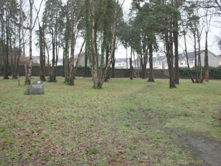 St. Conal's Psychiatric HospitalGraveyard/cemetery · 1076 yd
Explorer Tom St. Conal's Psychiatric Hospital graveyard holds a modern stone that simply says 'May they rest in peace' among so many…
 Church of the Irish MartyrsChurch/chapel · 1274 yd
Explorer Tom Church of the Irish Martyrs in Letterkenny has a roof lantern up top and bronze fish beside the font. It opened in 1994…
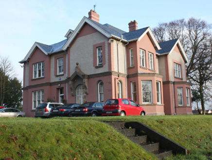 Tir Conaill House\Parkview HouseHouse · 1290 yd
Explorer Tom Tir Conaill House has round-headed windows with horned timber sashes that look like a sleepy bull peeking out from the…
 Kiltoy Church of Ireland ChurchChurch/chapel · 1315 yd
Explorer Tom Kiltoy Church of Ireland Church in Kiltoy is being picked on by the wind because its slate-hung gable end looks like…
 Bernard McGlinchey Town ParkPark · 1446 yd
Explorer Tom Bernard McGlinchey Town Park gives Letterkenny a generous patch of breathing room right beside the bustle, and it is…
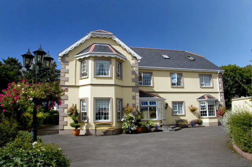 Ballyraine GuesthouseGuesthouse · 1447 yd
Explorer Tom Ballyraine Guesthouse is on Ramelton Road, which sounds like a place where you get lost easily and end up arguing with…
 Tropical WorldZoo or wildlife park · 1670 yd
Explorer Tom Tropical World near Letterkenny offers a fine trick on a grey Donegal day: step into a butterfly house and find…
 Battlefield in Ballyboe Lisenan,ballyraine,farsetmore,gortlee,kiltoy,magheranan,glebe (castlewray Ed)Battlefield · 1751 yd
Explorer Tom Battlefield in Ballyboe Lisenan claims a fake king visited to inspect the troops but got lost in the mud and never came…
Battle of FarsetmoreBattle · 1751 ydExplorer Tom Battle of Farsetmore in County Donegal is where Hugh O'Donnell kicked Shane O'Neill's backside into the River Swilly.…
 Cafe TraxCafé · 1759 yd
Explorer Tom Cafe Trax sounds like a place where they mix fuel and coffee for maximum speed. If you find a jet engine there, take it…
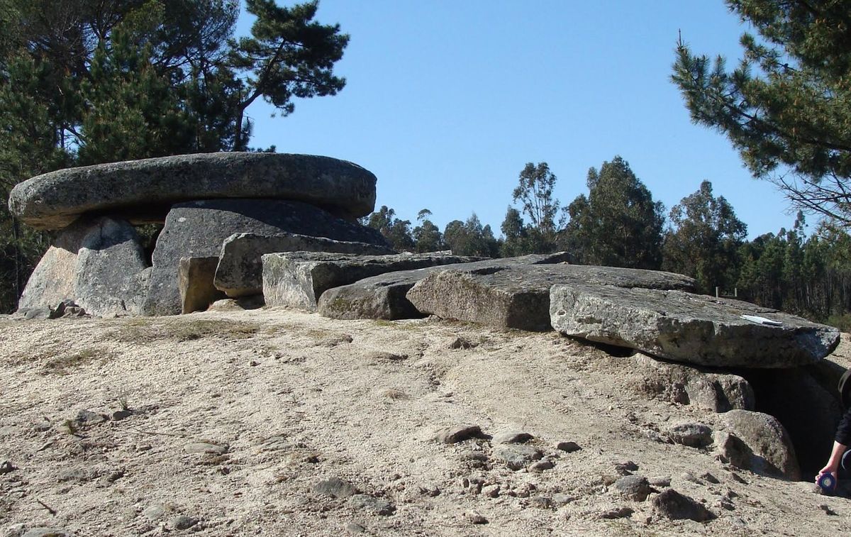 Megalithic tomb in CurraghleaMegalithic tomb · 1.3 mi
Explorer Tom Megalithic tomb in Curraghlea used to be a pair of 'ancient sepultures' with beds named after Darby and Grania. Fagan…
More archaeology and monuments in County Donegal · All of County Donegal

What do you know about this place?Tap to add a comment or ask a question