
What is recorded here
Listed as ‘Holy well’ in the RMP (1996) with the IG 12892, 19991 (ITM 528888, 699947). On inspection in 1999 this was described as being near the E end of a lowlying damp field with a huge natural boulder nearby to the E. It was apparently a simple ‘well’ enclosed by a drystone wall at S with a large upright limestone…
Read the whole record
From the National Monuments Service (Archaeological Survey of Ireland) record CL010-021007
Places near here
Photo credits
- Drow69, Wikimedia Commons · CC BY-SA 3.0
- Maker not stated on source page, www.dreamstime.com
- Maker not stated on source page, gypsymonika.blogspot.com
- Maker not stated on source page, www.go-to-ireland.com
- P L Chadwick, Geograph · Creative Commons Attribution-ShareAlike 2.0
- Maker not stated on source page, www.gettyimages.com
- Maker not stated on source page, commons.wikimedia.org
- Maker not stated on source page, www.pinterest.com
- Maker not stated on source page, www.istockphoto.com
- Maker not stated on source page, www.flickr.com
- Maker not stated on source page, www.gettyimages.co.nz
- Roger Diel, Geograph · CC BY-SA 2.0
 Templecronan (in ruins)Church · 96 yd
Explorer Tom Templecronan survived a storm that broke the local boatman’s back, and it just shrugged it off. The cyclopean masonry…
 Fairy fort / earthen ringfort in Ballyconry (burren By., Carron Ed)Fairy fort / earthen ringfort · 1052 yd
Explorer Tom Fairy fort / earthen ringfort in Ballyconry sits in a depression like it’s sulking at a party. It hates the famous…
 St. Fachnant's Holy WellVisitor attraction · 1366 yd
Explorer Tom St. Fachnant's Holy Well in County Clare is teaching history by example: keep digging until you find something weird or…
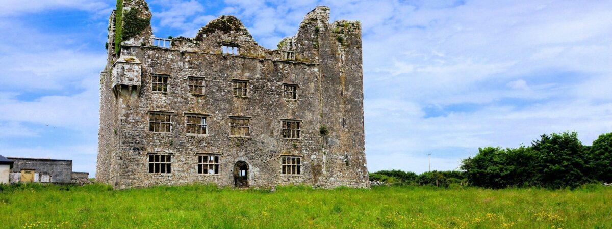 Castle (in ruins)Castle, unclassified · 1462 yd
Explorer Tom Castle in Fahee North is a garrison castle, which sounds like a very serious job title for a pile of dirt. Someone…
 Saint Columba's Catholic ChurchChurch/chapel · 1494 yd
Explorer Tom Saint Columba's Catholic Church in Crughwill is basically the village's living room, just with better lighting and more…
 Mapped cemeteryCemetery · 1547 yd
Explorer Tom Mapped cemetery in County Clare hates delivery drivers who park their vans too close to the headstones, so keep your…
 Enclosure in TullycommonEnclosure · 1643 yd
Explorer Tom Enclosure in Tullycommon sits right next to a lake that disappears when it feels like it. The local sheep think it’s…
 Cist in Castletown (burren By.)Cist · 1.6 mi
Explorer Tom Cist in Castletown is just four slabs trying to hold it together after a zombie attack. I reckon they survived because…
 Wedge tomb in CappaghkennedyWedge tomb · 1.7 mi
Explorer Tom Wedge tomb in Cappaghkennedy sits up high commanding wide views, probably judging your outfit from a distance. It was…
 Fairy fort / stone ringfort in Ballyganner NorthFairy fort / stone ringfort · 4.9 mi
Explorer Tom Fairy fort / stone ringfort in Ballyganner North would bring a flask of whiskey to any party. Westropp called it…
 Wedge tomb in Ballyganner NorthWedge tomb · 5.0 mi
Explorer Tom The Wedge tomb in Ballyganner North sits on the highest point of a cashel, which is definitely not the shortcut you…
 Ballyganner Castle (in ruins)Castle, tower house · 5.4 mi
Explorer Tom Ballyganner Castle in Ballyganner South is stuck in a feud with the rain, and the weather is winning badly. It’s…
More archaeology and monuments in County Clare · All of County Clare

What do you know about this place?Tap to add a comment or ask a question