What is recorded here
Some 50m NE of Teampall na Ceathraír Álainn (GA110-086001-). Thought named 'Holy Well' on the OS 6-inch map, this consists of a subrectangular bullaun stone (L 0.7m) half-hidden under a modern field wall with a possibly natural oval depression (0.3m by 0.2m) in its upper surface. Two medals were visible. Circa 17m to WSW in the adjoining field is another bullaun-like stone (GA110-087001-), indicated but not named on the 2nd ed. of OS 6-inch map, which is half-buried in the grass. Though no offerings are visible, local tradition attributes one cure (of blindness) to it many years ago (pers. comm. J. Waddell).
The above description is derived from the published 'Archaeological Inventory of County Galway Vol. I - West Galway'. Compiled by Paul Gosling (Dublin: Stationery Office, 1993). In certain instances the entries have been revised and updated in the light of recent research.
Updated by: Olive Alcock
Date of revised upload: 1 August 2017
Probably dates to the early Christian period, associated with a holy well and possibly used for ritual water collection or baptism. The bullaun stone may have had a sacred or healing function, linked to local Christian or pre-Christian traditions.
The monument record does not grant public access. Check the route and ask the landowner before entering private land.
- What survives
- Recorded monument
Places near here
 TempleancheathrairaluinnChurch · 81 yd
 SpeahgortatoberHoly well · 240 yd
 Dermot and Granias BedWedge tomb · 444 yd
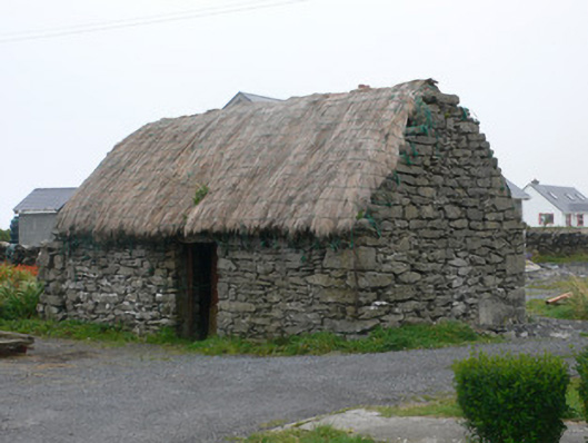 outbuildingoutbuilding · 463 yd
 Seal Colony LookoutViewpoint · 908 yd
 Dún EochlaHeritage attraction · 1183 yd
 ÁrainnIsland · 1603 yd
 An CharcairMountain / peak · 1.1 mi
 Liam o'Flaherty's BirthplaceHeritage attraction · 1.2 mi
 Trá na mBuailte (Beach of the Booly)Beach / strand · 1.9 mi
 Arkin's CastleCastle · 2.8 mi
 Castle (in ruins)Castle, unclassified · 2.9 mi