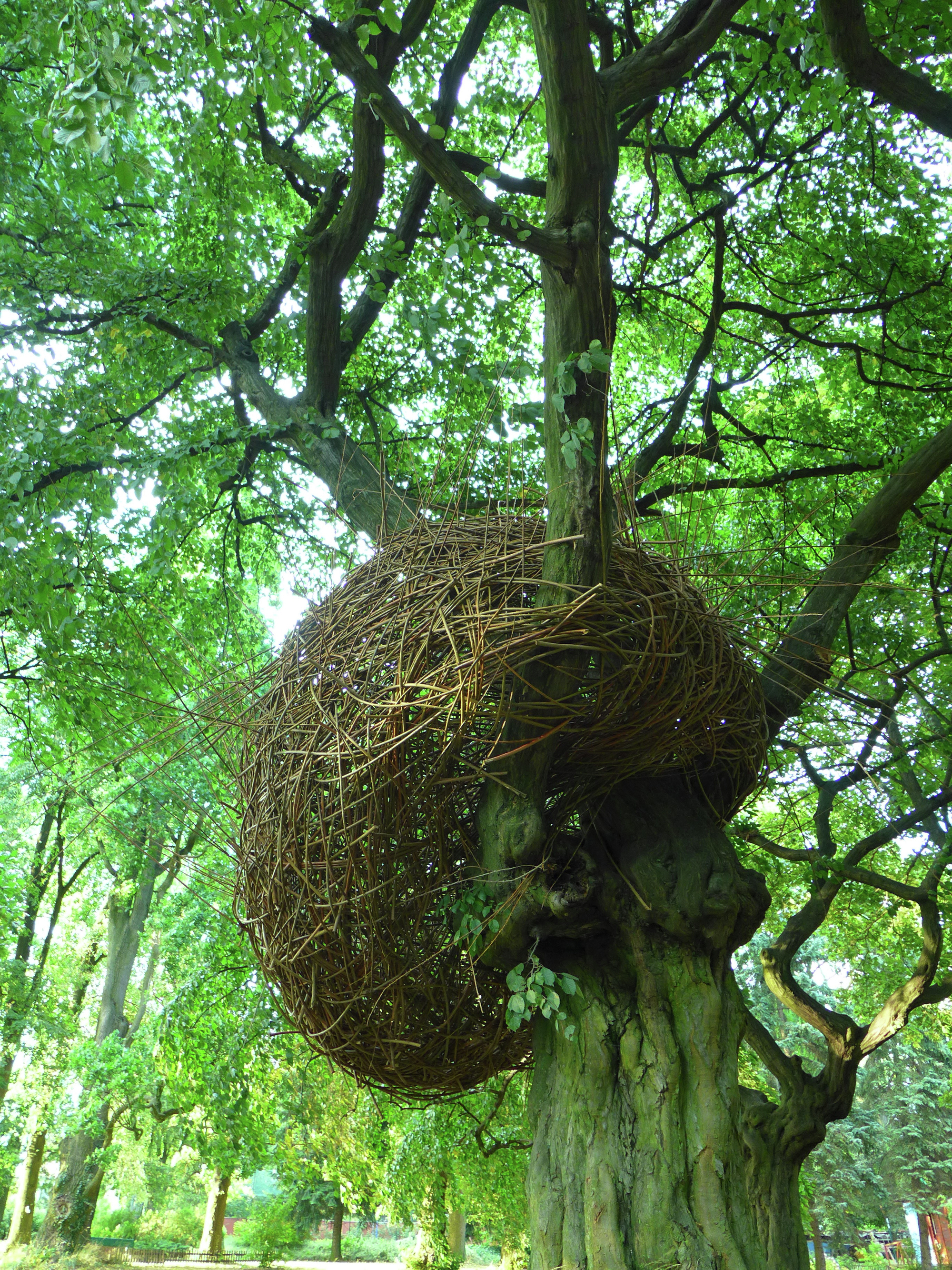
What is recorded here
Map note: The map marks Hens Nest Wood as a wood near East Whitburn, West Lothian, Scotland. The landscape can keep its secrets; the map gives away the location.
From OpenStreetMap (© OpenStreetMap contributors) w372586353
Places near here
Photo credits
- Richard Webb, Wikimedia Commons · CC BY-SA 2.0
- Maker not stated on source page, www.dreamstime.com
- Maker not stated on source page, fi.pinterest.com
- Andrew MacKinnon, Wikimedia Commons · CC BY-SA 2.0
- Graeme Yuill, Wikimedia Commons · CC BY-SA 2.0
- Maker not stated on source page, ca.pinterest.com
- Jim Smillie, Wikimedia Commons · CC BY-SA 2.0
- Maker not stated on source page, www.tripadvisor.ca
- Maker not stated on source page, en.m.wikipedia.org
- Ian Dodds, Wikimedia Commons · CC BY-SA 2.0
 East WhitburnCountry House (19th Century) · 149 yd
 East Whitburn, CemeteryCemetery (20th Century) · 303 yd
 Mapped cemeteryCemetery · 310 yd
 Whitburn, Shanks Road, Whitburn AcademySchool · 1011 yd
 Whitburn, East Main Street, Brucefield Church of ScotlandChurch (19th Century), Church Hall (20th Century) · 1150 yd
 Whitburn, Manse Road CemeteryCemetery (20th Century) · 1151 yd
 Whitburn War MemorialMemorial · 1306 yd
 Whitburn Community MuseumMuseum · 1343 yd
 Whitburn, Manse Road, Whitburn Parish Church, ChurchyardBurial Ground (post Medieval), Churchyard (post Medieval) · 1451 yd
 Standhill FarmNo Class (event) · 1.4 mi
 Armadale, Southdale AvenueRig and Furrow · 1.8 mi
 Little BogheadNature reserve · 1.9 mi
Explorer Tom Little Boghead Nature Park hides woodland, meadow and wet ground on Bathgate's edge, where an industrial past has made…
More woods, forests and old trees in West Lothian · All of West Lothian

What do you know about this place?Tap to add a comment or ask a question