
What is recorded here
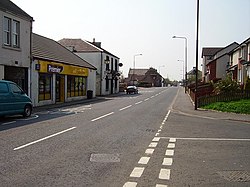
East Whitburn is a country house in West Lothian, Scotland.
From the Historic Environment Scotland record 47757
The historic-place record does not grant public access. Check current conditions and ownership before entering land or a building.
Places near here
Photo credits
- Andrew MacKinnon, Wikimedia Commons · CC BY-SA 2.0
- Graeme Yuill, Wikimedia Commons · CC BY-SA 2.0
- Jim Smillie, Wikimedia Commons · CC BY-SA 2.0
- Richard Webb, Wikimedia Commons · CC BY-SA 2.0
- Leslie Barrie, Wikimedia Commons · CC BY-SA 2.0
- Ian Dodds, Wikimedia Commons · CC BY-SA 2.0
- Greg Fitchett, Wikimedia Commons · CC BY-SA 2.0
 Whitburn, Shanks Road, Whitburn AcademySchool · 1124 yd
 Whitburn, East Main Street, Brucefield Church of ScotlandChurch (19th Century), Church Hall (20th Century) · 1279 yd
 Whitburn War MemorialMemorial · 1449 yd
 FoulshielsRig and Furrow (medieval) - (post Medieval) · 1720 yd
 BlackburnBattle Site (14th Century) · 1.2 mi
 Standhill FarmNo Class (event) · 1.4 mi
 Millennium Milepost Whiteside FarmVisitor information · 1.5 mi
 War MemorialMemorial · 1.8 mi
 Little BogheadNature reserve · 1.9 mi
 DardanellesHeritage attraction · 2.3 mi
 BathgateNo Class (event) · 2.5 mi
 Crane HillockMountain / peak · 2.7 mi
More historic places in West Lothian · All of West Lothian
What do you know about this place?