What is recorded here
Two shallow pits sat eight metres apart on a steep south-facing slope above the River Blackwater, their bases darkened by charcoal and one edge reddened by fire. They may have been hearths where people warmed themselves or cooked before the M3 motorway cut through Derver, though no dates or artefacts remain to prove it. The absence of evidence does not erase the heat; it only removes the witness.
Located on a steep S-facing slope of the River Blackwater valley, with a WNW-ESE section of the stream c. 370m to the S. Archaeological testing (04E1060) by D. Bayley (2005) at Testing Area 9 of Contract 5 of the M3 motorway identified archaeological features that were completely excavated (E003186) by S. Rathbone in January 2007 (excavations.ie 2007:1295) as Derver 2. It consisted of two pits (dims 1.2mx 1.04m; D 0.3m: 0.85m x 0.72m; D 0.07m) that were 8m apart, each filled with dark sandy clay with occasional small stones and frequent charcoal inclusions. A small part of the base of one pit was fire-reddened and they may have been hearths, although no artefacts were recovered and no radiocarbon dates are available. (Rathbone and Ginn 2008)
Compiled by: Michael Moore
Date of upload: 3 March 2022
The monument record does not grant public access. Check the route and ask the landowner before entering private land.
- What survives
- Recorded monument
Places near here
 FortsCastle, motte and bailey · 470 yd
 Mote of DerverArchaeological place · 492 yd
 Church in EdenburtChurch · 702 yd
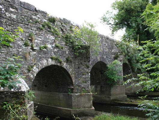 O'Daly's Bridgebridge · 1277 yd
 IndicatedEnclosure · 1551 yd
 Woodpole Fox CovertWood · 1.2 mi
 Feegat ForestWood · 1.3 mi
 Balgree MoteCastle, motte · 1.4 mi
 MaperathMountain / peak · 2.7 mi
 MountainpoleMountain / peak · 3.9 mi
 Oliver Plunkett memorialMemorial · 4.0 mi
 The Kieran Flanagan WayMemorial · 4.2 mi