
What is recorded here
-'Labra Lark's Castle' is a large double-walled cashel (DG044-022001-). An area of rock outcrop is enclosed by a ruined stone wall originally up to 2.4m in width. The inner face is up to 1m in height but appears to have been rebuilt in modern times. There is an entrance to the N from 1m to 2m in width. The central…
Read the whole record
From the National Monuments Service (Archaeological Survey of Ireland) record DG044-022003
Places near here
Photo credits
- Maker not stated on source page, en.wikipedia.org
- National Inventory of Architectural Heritage
- Kenneth Allen, Geograph · Creative Commons Attribution-ShareAlike 2.0
- Maker not stated on source page, www.flickr.com
- Maker not stated on source page, commons.wikimedia.org
- Maker not stated on source page, www.pinterest.com
- Chris Gunns, Wikimedia Commons · CC BY-SA 2.0
- Percita at Flickr, Wikimedia Commons · CC BY-SA 2.0
 Burial within Labra Lark's CastleBurial · 1 yd
Explorer Tom Burial within Labra Lark's Castle sits inside a massive double-walled fortress on a rocky ridge in Cloncarney. Fagan’s…
 bridge1074 yd
Explorer Tom Bridge in Carnatreantagh has blue engineering brick voussoirs tucked inside a stone arch. Why would an engineer pick…
 Trenta Presbyterian ChurchChurch/chapel · 1186 yd
Explorer Tom Trenta Presbyterian Church was built around 1836, with a porch dated 1902. Its coloured glass sits in pointed windows…
 Children's burial ground in Carrick (templedouglas Ed)Children's burial ground · 1.2 mi
Explorer Tom Children's burial ground in Carrick was originally a circle, though only half of the earthen bank survives today.…
 Carrick Children's Burial GroundChildren's burial ground · 1.2 mi
Explorer Tom Carrick Children's Burial Ground is a subrectangular patch of stony ground hidden in the rough, rocky terrain here.…
 Stone head in TirargusStone head · 1.2 mi
Explorer Tom Stone head in Tirargus is officially gone, which is wild! I bet it rolled off a cart and hid under a hedge to sulk.…
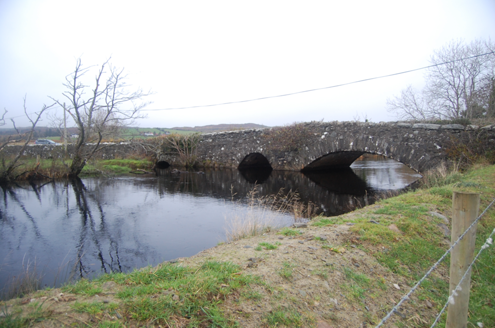 Bellaned BridgeBridge · 1.2 mi
Explorer Tom Bellaned Bridge uses one wide arch and a smaller pointed one over the Lennan River, with two little flood arches beside…
 Doon WellHoly well · 1.3 mi
Explorer Tom Doon Well sits below steps inside a later wall. An 1889 account said two returning priests blessed it and that pilgrims…
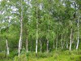 Silver Birch1.3 mi
Explorer Tom Silver Birch in County Donegal is having a massive screaming match with the nearest tree over who looks better in…
 Barrack BridgeBridge · 1.3 mi
Explorer Tom Barrack Bridge was built around 1800 with two round arches over the Leannan River and an oversized triangular cutwater…
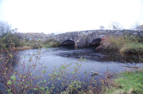 Dromore BridgeBridge · 1.4 mi
Explorer Tom Dromore Bridge has carried a road over the Leanne River since around 1780. Its two stone arches may contain pieces of…
 Battle at Doon Rock, KilmacrennanBattle · 1.4 mi
Explorer Tom Battle at Doon Rock, Kilmacrennan in County Donegal is where Sir Cahir O'Doherty finally lost his battle against a…
More archaeology and monuments in County Donegal · All of County Donegal

What do you know about this place?Tap to add a comment or ask a question