Places near here
Photo credits
- M J Richardson, Wikimedia Commons · CC BY-SA 2.0
- Richard Webb, Wikimedia Commons · CC BY-SA 2.0
- Walter Baxter, Wikimedia Commons · CC BY-SA 2.0
- Oliver Dixon, Wikimedia Commons · CC BY-SA 2.0
- Peter Bond, Wikimedia Commons · CC BY-SA 2.0
- Jim Barton, Wikimedia Commons · CC BY-SA 2.0
- Peter Wood, Wikimedia Commons · CC BY-SA 2.0
 Branxholm BridgeRoad Bridge (20th Century) · 370 yd
 HaysikeQuarry (post Medieval) · 460 yd
 Goldielands TowerBarmkin (16th Century), Tower House (16th Century) · 493 yd
 Branxholmpark HillQuarry (post Medieval) · 654 yd
 FenwickFarmhouse (17th Century) · 728 yd
 Borthaugh CottagesRoad (post Medieval) · 953 yd
 Martin's BridgeDrain(s), Field Boundary(s) · 1019 yd
 BorthaughFindspot, Axehead (stone) · 1092 yd
 Borthaugh CovertWood · 1256 yd
 Overhall WoodWood · 1508 yd
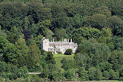 Branxholme CastleBarmkin (16th Century), Castle (16th Century) · 1616 yd
 Nan Lyle MemorialMemorial · 1.2 mi
More historic places in Scottish Borders · All of Scottish Borders

What do you know about this place?Tap to add a comment or ask a question