
What is recorded here
From OpenStreetMap (© OpenStreetMap contributors) n13623599428
Places near here
Picture notes
- Kenneth Allen, Geograph · CC BY-SA 2.0
- Computer-made picture. It does not show this mountain top.
- Computer-made picture. It does not show this monument.
- Computer-made picture. It does not show this walking route.
- David Trochos at English Wikipedia, Wikimedia Commons · Public domain
- Albert Bridge, Geograph · CC BY-SA 2.0
- Colin Park, Geograph · CC BY-SA 2.0
- Colin Park, Wikimedia Commons · CC BY-SA 2.0
- Kenneth Allen, Wikimedia Commons · CC BY-SA 2.0
 Ballyhanna ForestForest · 933 yd
 Coal HillMountain / peak · 1118 ydComputer-made picture
 Cairn (unlocated) in AltikeeraghCairn (unlocated) · 1350 ydComputer-made picture
Explorer Tom Cairn in Altikeeragh is unlocated, so it’s having a quiet rivalry with more famous places nearby. Bring biscuits, because every good story needs biscuits to go with it.
 Booley site? in Grange ParkBooley Site? · 1752 ydComputer-made picture
Explorer Tom Booley site? in Grange Park has a question mark because nobody can prove it existed. It’s uncertain and mysterious, like your ex. If it ordered at a chipper, it would get just mushy peas. Get there early and have it all to yourself.
 Causeway Coast and Glens - 14 - BinevenaghWalking route · 1.5 miComputer-made picture
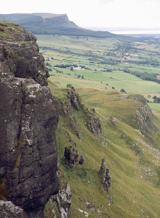 BinevenaghMountain / peak · 1.7 mi
 Ballyhacket ViewPicnic place · 1.8 mi
 Binevenagh ViewViewpoint · 2.0 mi
 Manannán mac LirSculpture · 2.4 mi
 Aidan's WellSpring · 2.7 mi
 Aghanloo Church of Ireland ChurchChurch · 3.0 mi
Explorer Tom Aghanloo's Church of Ireland was built in the 1820s and once a cow tried to buy it with a carrot. It's now just a church, but with drama. Stand still and listen, the wind tells it better than me and probably judges you less.
 Eagle HillMountain / peak · 3.1 miComputer-made picture
More mountains and hills in County Derry · All of County Derry

What do you know about this place?Tap to add a comment or ask a question