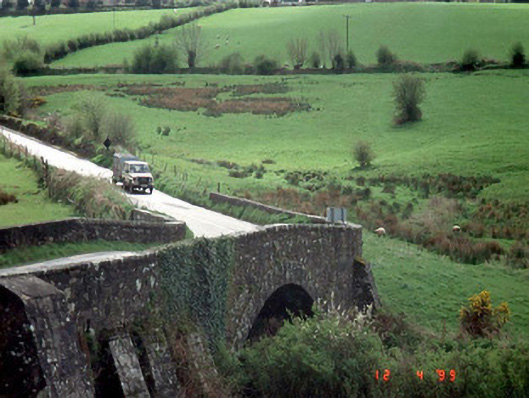
What is recorded here
Single-arch road bridge over river, dated 1829, with cut stone voussoirs and coping.
This does not grant access. Most recorded buildings are privately owned; view them only from public ground unless the owner allows entry.
Places near here
 Church Hill, Graveyard (site of)Church · 447 yd
 Church of Saint John the Baptist (Hacketstown)church/chapel · 530 yd
 Saint Brigid's Catholic Churchchurch/chapel · 744 yd
 IndicatedEnclosure · 1.0 mi
 Eagle HillMountain / peak · 1.1 mi
 Sessile OakSessile Oak · 1.9 mi
 Chapel (in ruins), GraveyardChurch · 2.7 mi
 Clonmore Castle (in Ruins)Castle, Anglo-Norman masonry castle · 2.9 mi
 Clonmore MoatCastle, motte and bailey · 2.9 mi
 European BeechEuropean Beech · 3.3 mi
 Church (in ruins), GraveyardChurch · 4.4 mi
 Ballycumber HillMountain / peak · 4.4 mi
Other information
Photo: National Inventory of Architectural Heritage · Website use allowed for educational or private purposes with source credit