What is recorded here
This commemorative plaque records: Guildford The town of Guildford lies in the gap where the river Wey cuts through the chalk ridge of the North Downs. The main routes in West Surrey converged to cross the river, over the ford on the site of the old town bridge. It was to this spot that the first Saxon migrants came in about the year AD500, to settle at Gyldeforda - "the golden ford". The coat of arms of Guildford include the wavy lines that represent the ford. In the mid 600s, these pagan Saxons became Christians and St. Mary's Church nearby in Quarry Street has a late Saxon tower. In the Middle ages Guildford thrived as a centre for the wool trade. Lying halfway between London and the South Coast, it was well placed for trade. Although small throughout the Middle Ages, Guildford was a prosperous town having the status of a borough from the 10th century and was recognised by Henry III as the county town of Surrey. As a centre of the local road network, Guildford had a large number of inns and public houses. Opposite, White Lion Walk marks the site of the great White Lion coaching inn, demolished in 1957. Nearby, The Star was the base for most of the 'carriers' in Georgian and Victorian times. These men would transport goods to and from the outlying villages. Both The Star and the building facing it have the distinctive 'jetty', where the upper storey projects beyond the ground floor. Both date from the late Elizabethan period. The granite setts (not cobbles) have been a feature of Guildford High Street since 1869. Recorded plaque organisation: Guildford Historic Trail.
From the Open Plaques record 8704
A plaque record does not grant entry to a building or private land. View it from a public place unless permission is clearly given.
Places near here
 Church of St MaryListed building · 83 yd
 The Angel HotelListed building · 104 yd
 The treadwheel craneScheduled monument · 162 yd
 Alice sculpturePublic sculpture · 164 yd
 Guildford MuseumMuseum · 203 yd
 CastleViewpoint · 214 yd
 Guildford CastleScheduled monument · 267 yd
 War MemorialMemorial · 275 yd
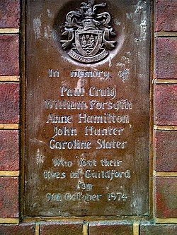 Guildford pub bombingsBomb attack · 336 yd
 Guildford Borough Boundary StoneMonument or public art · 492 yd
 Pewley HillMountain / peak · 1014 yd
 Grotto Below St Catherine's HillCave or cavern · 1244 yd
Pictures: N Chadwick, Wikimedia Commons · CC BY-SA 2.0; Colin Smith, Wikimedia Commons · CC BY-SA 2.0; Noel Foster, Wikimedia Commons · CC BY-SA 2.0; Basher Eyre, Wikimedia Commons · CC BY-SA 2.0; Murgatroyd49, Wikimedia Commons · CC BY-SA 4.0
What do you know about this place?