
What is recorded here
Situated in a large rolling field with a hill to the E and S and another rising to the SW. Not visible at ground level. All field boundaries have been removed and the field has been reclaimed. The site is indicated on the 1st ed. OS 6-inch map as an irregular-shaped area defining Killederdadrum graveyard but is not…
Read the whole record
From the National Monuments Service (Archaeological Survey of Ireland) record TN027-100006
Places near here
Photo credits
- Maker not stated on source page, www.pinterest.com
- Maker not stated on source page, en.wikipedia.org
- Maker not stated on source page, www.dreamstime.com
- National Inventory of Architectural Heritage
- Maker not stated on source page, commons.wikimedia.org
- Maker not stated on source page, www.tripadvisor.com.au
- Maker not stated on source page, uk.pinterest.com
 Church in LackenavornaChurch · 1 yd
Explorer Tom Church in Lackenavorna in County Tipperary has a resident bird that refuses to leave despite the complete lack of…
 Earthwork in LackenavornaEarthwork · 1080 yd
Explorer Tom Earthwork in Lackenavorna caused such a massive argument in the parish that the whole thing got flattened out just to…
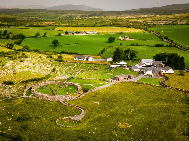 Fairy fort / earthen ringfort in FalleenyFairy fort / earthen ringfort · 1.0 mi
Explorer Tom Fairy fort / earthen ringfort in Falleeny smells like old earth and regret, according to me, which is quite poetic…
 Fairy fort / earthen ringfort in CloghonanFairy fort / earthen ringfort · 1.1 mi
Explorer Tom Fairy fort / earthen ringfort in Cloghonan brags about surviving storms that flattened everything else nearby. It’s…
 Castle OtwayGate lodge · 1.4 mi
Explorer Tom Castle Otway’s gate lodge has a tower that looks like it wandered in from a different building entirely. The slate roof…
 Fairy fort / earthen ringfort in Loughane UpperFairy fort / earthen ringfort · 1.7 mi
Explorer Tom Fairy fort in Loughane Upper got its name wrong because the map makers were drunk or lazy, probably both. It’s just a…
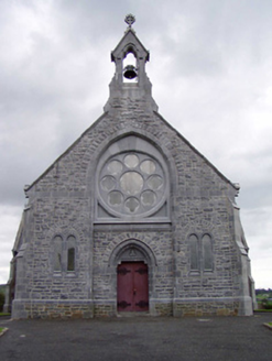 Catholic Church of the Immaculate ConceptionChurch/chapel · 1.8 mi
Explorer Tom Catholic Church of the Immaculate Conception in Cloghinch was nearly sold for a horse, but the rose window said no. The…
 CastleCastle, unclassified · 3.1 mi
Explorer Tom Castle in Ballylisheen started as a bet between two lads who swore they could build a stump of a castle before the next…
 Fairy fort / earthen ringfort in Pollanorman (ballynaclogh Par.)Fairy fort / earthen ringfort · 3.7 mi
Explorer Tom Fairy fort / earthen ringfort in Pollanorman would walk into a job interview and say it’s experienced in earth-moving…
 Rathurles CastleCastle, tower house · 5.5 mi
Explorer Tom Rathurles Castle would post on social media a picture of its murder-hole with the caption 'Who needs privacy when you…
 Lisbunny Old GraveyardGraveyard · 5.6 mi
Explorer Tom Lisbunny Old Graveyard got lost looking for the Vikings because it didn't check its compass and ended up in a bog…
 Lisbunny New CemeteryCemetery · 5.7 mi
Explorer Tom Lisbunny New Cemetery is haunted by a poet who fell in the ditch nearby and now recites terrible couplets about mud at…
More memorials and graveyards in County Tipperary · All of County Tipperary

What do you know about this place?Tap to add a comment or ask a question