
What is recorded here
From the National Monuments Service (Archaeological Survey of Ireland) record CL011-008
Places near here
Photo credits
- Mike Searle, Wikimedia Commons · CC BY-SA 2.0
- National Inventory of Architectural Heritage
- Maker not stated on source page, www.pinterest.com
- Maker not stated on source page, ru.pinterest.com
- Maker not stated on source page, en.wikipedia.org
- The Clare Echo; photographer not named in the article, www.clareecho.ie
- Dr Charles Nelson, Wikimedia Commons · CC BY-SA 2.0
- Humphrey Bolton, Geograph · CC BY-SA 2.0
- Andreas F. Borchert, Wikimedia Commons · CC BY-SA 4.0
- John M, Geograph · CC BY-SA 2.0
 Cloondooan Castle (in ruins)Castle, tower house · 468 yd
Explorer Tom Cloondooan Castle in Rockvale sits on a rocky ridge like it’s waiting for someone to lose a bet there. It overlooks…
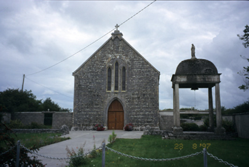 All Saints' Catholic ChurchChurch/chapel · 1065 yd
Explorer Tom All Saints' Catholic Church in Kylecreen added a lean-to bay in 1995, so it’s got one foot in the 1800s and one in the…
 forest parkVisitor information · 1368 yd
Explorer Tom Forest park is just trees having a massive meeting about who’s the tallest. The local sheep think they’re in charge…
 Puckada IslandIslet · 1521 yd
Explorer Tom Puckada Island would tell its younger self to stop worrying about the tides and start enjoying the wind in its grass.…
 Wedge tomb in BallaghaglashWedge tomb · 1.1 mi
Explorer Tom The Wedge tomb in Ballaghaglash nearly got famous once when someone mistook it for a giant stone loaf of bread. It’s…
Gull IslandIslet · 1.2 miExplorer Tom Gull Island in County Clare would describe itself to a stranger as a "modest bump in the water with excellent views of…
 Tubber GAA pitchGAA ground · 1.2 mi
 Cloonselkerny Castle (ruins)Castle · 1.3 mi
Explorer Tom Cloonselkerny Castle is currently the site of a fierce fairy dispute over who gets to park their tiny chariots in the…
 Cloghans or Round TowerRound tower · 1.7 mi
Explorer Tom Cloghans or Round Tower in Kilmacduagh holds the fake world record for being breached on the SW side and looking…
 Kilmacduagh MonasteryHeritage attraction · 1.7 mi
Explorer Tom Kilmacduagh gives you a round tower and a name that has outlived several different churches. I would call it the seven…
 Church of St. John the Baptist (in ruins)Church · 1.7 mi
Explorer Tom Church of St. John the Baptist at Kilmacduagh claims a fiddler played there all night until sunrise. He probably just…
 Kilmacduagh Monastic SiteVisitor information · 1.8 mi
Explorer Tom Kilmacduagh Monastic Site thinks Dublin tourists are basically overgrown children who need a stern lecture about…
More archaeology and monuments in County Clare · All of County Clare

What do you know about this place?Tap to add a comment or ask a question