What is recorded here
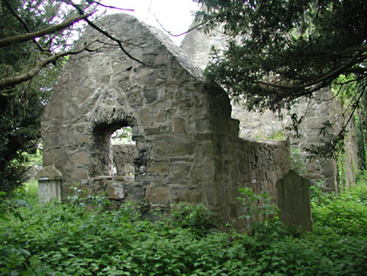
Enclosed churchyard containing ruins of single-cell church, c.1675, and collection of gravestones dating from the early nineteenth to mid twentieth century. Large yew tree. Limestone rubble boundary wall.
This site, in religious use since the seventeenth century and containing a good group of headstones, is an example of unbroken function, and is therefore a valuable social and historical document.
From the Buildings of Ireland (National Inventory of Architectural Heritage) record 11203013
This does not grant access. Most recorded buildings are privately owned; view them only from public ground unless the owner allows entry.
Places near here
Graveyard in Palmerstown LowerGraveyard · 14 yd Ivagh CottageWorker's house · 84 ydworker's house87 ydIndicatedBarrow, ring-barrow · 230 ydFarmleighVisitor information · 674 ydFurry GlenWood · 739 ydFarmleighHeritage attraction · 904 ydNational Famine WayWalking route · 1154 ydThe Royal Canal WayWalking route · 1164 ydCastleknock CastleCastle · 1345 ydOldtown WoodWood · 1683 ydKnockmaree DolmenArchaeological place · 1.0 mi
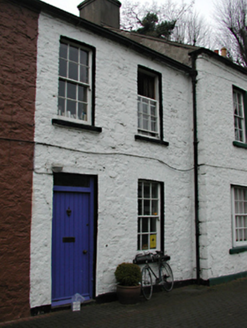
 Ivagh CottageWorker's house · 84 yd
 worker's house87 ydIndicatedBarrow, ring-barrow · 230 ydFarmleighVisitor information · 674 ydFurry GlenWood · 739 yd
 FarmleighHeritage attraction · 904 ydNational Famine WayWalking route · 1154 yd
 The Royal Canal WayWalking route · 1164 yd
 Castleknock CastleCastle · 1345 yd
 Oldtown WoodWood · 1683 yd
 Knockmaree DolmenArchaeological place · 1.0 mi
Pictures: National Inventory of Architectural Heritage; DubhEire, Wikimedia Commons · CC0; JP, Geograph · CC BY-SA 2.0; Laurel Lodged, Wikimedia Commons · CC BY-SA 4.0; Pier Paolo Lisarelli, Wikimedia Commons · CC BY-SA 4.0
More historic places in County Dublin · All of County Dublin
What do you know about this place?