What is recorded here
From the National Monuments Service (Archaeological Survey of Ireland) record OF022-011
Places near here
Photo credits
- Maker not stated on source page, www.pinterest.com
- Maker not stated on source page, www.dreamstime.com
- National Inventory of Architectural Heritage
- Kieran Campbell, Wikimedia Commons · CC BY-SA 2.0
- Maker not stated on source page, commons.wikimedia.org
- Maker not stated on source page, www.rte.ie
- Eric Jones, Geograph · CC BY-SA 2.0
 Holy well in Cush EastHoly well · 131 yd
Explorer Tom Holy well in Cush East is currently hiding under a big concrete slab because nobody wanted to take the risk of falling…
 Killourney CemeteryCemetery · 850 yd
Explorer Tom Killourney Cemetery in County Offaly has a dating profile that just reads 'Looking for someone who respects my…
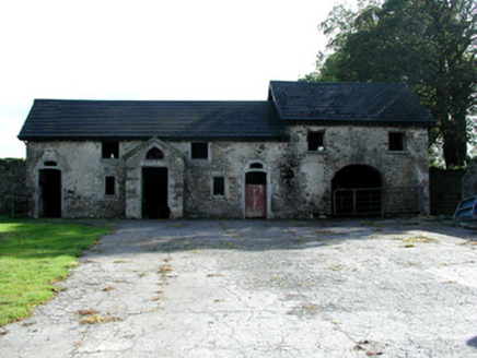 Strawberry HillFarmyard complex · 1125 yd
Explorer Tom Strawberry Hill farmyard complex has an entrance that looks like it was carved by a drunk sculptor. The rustic…
 Belmont and Cloghan Railway StationStore/warehouse · 1271 yd
Explorer Tom Belmont and Cloghan Railway Station in Ballingowan Glebe was once an escape plan for a nervous accountant. The building…
 33rd LockBridge · 1506 yd
Explorer Tom The 33rd Lock was built on a bargain where the canal promised never to flood the village, which is a bit of a lie. The…
 store/warehouse1527 yd
Explorer Tom Store or warehouse in Ballingowan Glebe is hiding a treasure that is almost certainly just a rusty biscuit tin left…
 Killagally ParkRectory/glebe/vicarage/curate's house · 1668 yd
Explorer Tom Killagally Park was taken over by a fox who now runs the renovation project with an iron fist. The door is huge…
 weir1680 yd
Explorer Tom The weir in Ballingowan Glebe is basically a giant speed bump for fish, and it hasn’t stopped working since the mill…
 Enclosure in NoggusboyEnclosure · 1.3 mi
Explorer Tom Enclosure in Noggusboy has a bird that refuses to leave because it thinks the invisible circle is its personal throne…
 Cloghan, St Rynaghs FootballGAA ground · 1.5 mi
 Cloghan HillMountain / peak · 1.6 mi
Explorer Tom Cloghan Hill in Offaly thinks all tourists from Dublin are just lost actors looking for their next big break. It keeps…
 Mapped cemeteryCemetery · 1.9 mi
Explorer Tom Mapped cemetery in County Offaly once saw a dramatic scene where a very confused goose landed on a headstone and…
More archaeology and monuments in County Offaly · All of County Offaly

What do you know about this place?Tap to add a comment or ask a question