
What is recorded here
From the National Monuments Service (Archaeological Survey of Ireland) record KD020-007012
Places near here
Photo credits
- Maker not stated on source page, commons.wikimedia.org
- Bogman, Wikimedia Commons · CC BY-SA 3.0
- Maker not stated on source page, readymap.irish
- Maker not stated on source page, en.wikipedia.org
- National Inventory of Architectural Heritage
- Colin Park, Geograph · CC BY-SA 2.0
- Maker not stated on source page, nexusnewsfeed.com
- Guinevere's Garden; photographer not stated, Guinevere's Garden
- Maker not stated on source page, www.irishmirror.ie
 Cross-inscribed stone (present location) in Kilteel UpperCross-inscribed stone (present location) · 7 yd
Explorer Tom Cross-inscribed stone in Kilteel Upper is buried in a church wall, looking like it wants a quiet retirement. It…
 Church (in Ruins)Church · 7 yd
Explorer Tom Church in Kilteel Upper would complain to the council that the grass is too long and the tourists are too loud. It’s…
 Kilteel GraveyardGraveyard · 13 yd
Explorer Tom Kilteel Graveyard’s name actually means "The Hill Where We Forgot To Put Fences," according to my very reliable uncle.…
 Kilteel CastleCastle, tower house · 226 yd
Explorer Tom Kilteel Castle was guarded by Knights Hospitallers who probably spent all night playing fiddle tunes that drove the…
 Earthwork in Kilteel LowerEarthwork · 357 yd
Explorer Tom Earthwork in Kilteel Lower gets picked on by the wind because it’s too quiet. It’s a broad bank that refuses to show…
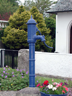 water pump387 yd
Explorer Tom Water pump in Kilteel Lower claims to be older than the hills themselves if you believe its marketing team. It's…
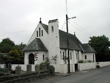 Catholic Church of Saint Laurence O'TooleChurch/chapel · 408 yd
Explorer Tom Catholic Church of Saint Laurence O'Toole has been in a bitter feud with the rain since 1935. The designer wanted…
 Cupidstown HillMountain / peak · 1.3 mi
Explorer Tom Cupidstown Hill is claimed by a local who says he invented it while walking his dog, which is bold but I respect the…
 Fairy fort / ringfort in BadgerhillFairy fort / ringfort · 1.4 mi
Explorer Tom Fairy fort / ringfort in Badgerhill is on a hill but not visible at ground level, so its first owner probably had an…
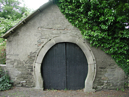 forge/smithy1.6 mi
Explorer Tom Forge or smithy in Calliaghstown Lower is a rare survivor with an inscribed stone arch that screams history. The…
 June Blake's GardenGarden · 2.1 mi
Explorer Tom June Blake's Garden at Tinode began with a sheep paddock and grew into three acres that seem to have quietly outwitted…
 Mapped cemeteryCemetery · 2.4 mi
Explorer Tom Mapped cemetery in County Dublin is sick of being asked if it’s haunted, because yes, obviously, but that’s not the…
More archaeology and monuments in County Kildare · All of County Kildare

What do you know about this place?Tap to add a comment or ask a question