
Places near here
Photo credits
- National Inventory of Architectural Heritage
- Dirk Huth, Wikimedia Commons · CC BY-SA 3.0
- Vanessa Kennedy, Wikimedia Commons · CC BY 2.0
- DeeEmm, Geograph · CC BY-SA 2.0
- Jan Wyk, Wikimedia Commons · Public domain
- Peter Allen, Wikimedia Commons · CC BY-SA 2.0
- Picture: Discover Ireland
- Michael Deligan, Wikimedia Commons · CC BY-SA 4.0
- Willow, Wikimedia Commons · CC BY 2.5
- Mike Searle, Wikimedia Commons · CC BY-SA 2.0
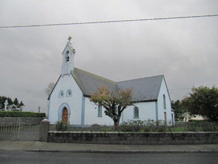 Catholic Church of Our Lady of LourdesChurch/chapel · 25 yd
Explorer Tom Catholic Church of Our Lady of Lourdes in Wallscourt would win a county fair just by standing there and being polite. Its bellcote is sharper than the opinions it probably holds about parking. Bring a friend who talks too much, let them fill the silence.
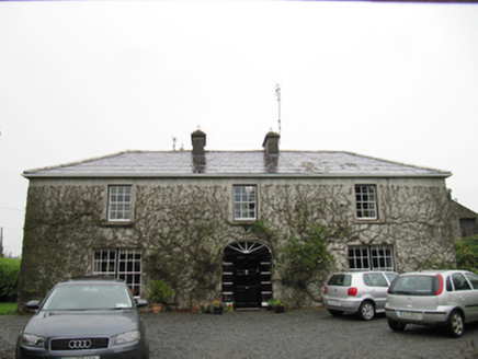 The CottageHouse · 1629 yd
Explorer Tom The Cottage in Cloonmain had Vikings get lost looking for it because they couldn't find a compass or a decent map. It’s symmetrical and slate-roofed, surviving a fire long ago which just added to its rugged charm. Bring your own legend, the locals are busy making their own.
TobermacduaghHoly well · 1.4 miExplorer Tom Tobermacduagh in Carrowroe sits on a ridge next to a dredged stream. It used to be surrounded by boulders, but now it’s just vibing alone, feeling a bit left out. Tell your mates you found it first.
 Turoe StoneHeritage attraction · 4.7 mi
 St. Brendans Catholic CathedralCathedral · 5.2 mi
Explorer Tom St. Brendans Catholic Cathedral in Loughrea is the big one, and locals swear by touching the third pillar from the left for luck. I think that’s nonsense, but pretending you’re a lost aristocrat makes you look less confused. Pretend you're a lost aristocrat, nobody will check.
 Long PointHeadland · 5.5 mi
.jpg/250px-Battle_of_Aughrim_by_Jan_Wyk_(cropped).jpg "Photo: Jan Wyk, Wikimedia Commons · Public domain") Battle of AughrimMajor battlefield · 7.3 mi
Battle of AughrimMajor battlefield · 7.3 mi Kilconnell AbbeyVisitor attraction · 7.4 mi
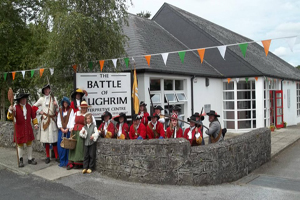 Battle of Aughrim Interpretative CentreMuseum · 7.5 mi
 Pallas CastleCastle, tower house · 8.1 mi
Explorer Tom Pallas Castle is one of Ireland’s biggest tower houses, which means it has the ego to match. Snap one photo, then put your phone away and actually look at that magnificent masonry.
 European ash11 mi
_-_geograph.org.uk_-_4070639.jpg/250px-Castles_of_Connacht,_Killure,_Galway_(1)_-_geograph.org.uk_-_4070639.jpg "Photo: Mike Searle, Wikimedia Commons · CC BY-SA 2.0") Killure Castle (in ruins)Castle, tower house · 11 mi
Killure Castle (in ruins)Castle, tower house · 11 miExplorer Tom Killure Castle in Galway has a murder-hole that probably just looks at you now. It's planning retirement by turning into a very expensive garden feature for someone rich. Hum something sad nearby, it adds atmosphere.
More archaeology and monuments in County Galway · All of County Galway

What do you know about this place?Tap to add a comment or ask a question