
What is recorded here
On a low rise in rolling pasture and marshy scrub. Indicated on the 1840 and 1916 eds. OS 6-inch maps. A five-sided graveyard (29m N-S; 79m E-W) surrounding a medieval church (CL015-027001-), entered by a gate and stile at E. The enclosing stone wall is drystone-built (H 1.25-1.6m; T at base 1m) and partially covered…
Read the whole record
From the National Monuments Service (Archaeological Survey of Ireland) record CL015-027002
Places near here
Photo credits
- Maker not stated on source page, en.wikipedia.org
- National Inventory of Architectural Heritage
- Maker not stated on source page, commons.wikimedia.org
- Gordon Hatton, Geograph · CC BY-SA 2.0
- Maker not stated on source page, ru.pinterest.com
- Maker not stated on source page, tr.pinterest.com
- Maker not stated on source page, www.tripadvisor.ru
- Roger Diel, Geograph · CC BY-SA 2.0
- Bob Jones, Geograph · CC BY-SA 2.0
- WikiDon at English Wikipedia, Wikimedia Commons · CC BY-SA 3.0
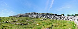 Fairy fort / earthen ringfort in Carrowduff (kilshanny Ed)Fairy fort / earthen ringfort · 501 yd
Explorer Tom The local guy swears he invented this ringfort himself when he was twelve, and honestly? I believe him. It’s got that…
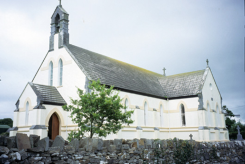 Saint Augustine's Catholic ChurchChurch/chapel · 1059 yd
Explorer Tom Saint Augustine's Church has lancet windows that look like they’re trying to slice through the sky. Built in 1893, it’s…
 Fairy fort / earthen ringfort in BallymacravanFairy fort / earthen ringfort · 1665 yd
Explorer Tom Fairy fort / earthen ringfort in Ballymacravan is squatting on a marshy hill like it owns the place. It’s got imported…
 Smithstown Castle (in ruins)Castle, tower house · 1.2 mi
Explorer Tom Smithstown Castle on a rocky outcrop is officially gone, but I swear it’s just napping. It thinks Dublin tourists are…
 Standing stone in Ballingaddy WestStanding stone · 2.1 mi
Explorer Tom Standing stone in Ballingaddy West got lost on purpose because it saw a Viking ship and wanted to see what was behind…
 Standing stone in KillaspuglonaneStanding stone · 2.2 mi
Explorer Tom Standing stone in Killaspuglonane is being used as a scratching post by local sheep, which feels like a personal insult…
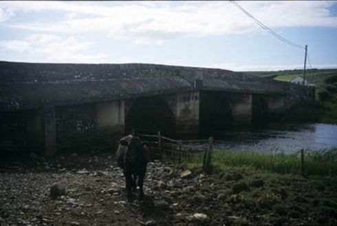 New BridgeBridge · 2.4 mi
Explorer Tom New Bridge in Ballingaddy West thinks it's the cool cousin because it has three arches instead of one. Its fan club…
Fairy fort / earthen ringfort in BallyfaudeenFairy fort / earthen ringfort · 3.2 miExplorer Tom Fairy fort / earthen ringfort in Ballyfaudeen has a hidden message in its stones if you squint hard enough. It's just a…
 Kilmacreehy CemeteryGraveyard · 4.4 mi
Explorer Tom Kilmacreehy Cemetery caused such a massive row last year over who owned the corner plot that half the parish still…
 Liscannor Castle (in Ruins)Castle, tower house · 5.3 mi
Explorer Tom Liscannor Castle has a secret it’d spill after three pints, likely about which neighbour stole its flag in the 14th…
 Wild Atlantic Way: Doolin PierVisitor information · 5.5 mi
Explorer Tom Wild Atlantic Way Doolin Pier was once ruled by a goat who wore a tiny crown made of bottle caps and demanded tribute…
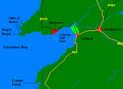 Liscannor BayBay · 6.9 mi
Explorer Tom Liscannor Bay is a great big Atlantic grin on County Clare's coast, with Liscannor village on one side and the sand at…
More archaeology and monuments in County Clare · All of County Clare

What do you know about this place?Tap to add a comment or ask a question