DDiscover AloneMapAbout

Graveyard in Murher

Graveyard
Computer-made picture that does not show Graveyard in MurherNot a photo of this monument
Computer-made picture. It does not show this monument. · Report the wrong picture

What is recorded here

Church and graveyard described by Toal (1995, no. 935) as follows; 'Murhur Church (in ruins), Graveyard (KE006-015001-). The 8th century genealogy of the Ciarraige refers to Murhur (Mag nAirthir) as a church site which was founded by Bishop Fáelán of the local ruling dynasty (BAR 102, 1982, 329). From at least the…

Read the whole record
Church and graveyard described by Toal (1995, no. 935) as follows; 'Murhur Church (in ruins), Graveyard (KE006-015001-). The 8th century genealogy of the Ciarraige refers to Murhur (Mag nAirthir) as a church site which was founded by Bishop Fáelán of the local ruling dynasty (BAR 102, 1982, 329). From at least the 14th century it was administered by the Augustinian canons at Rattoo. Today the ruins of the old parish church can still be seen in the graveyard'. In 2011 a graveyard survey carried out by Ann Frykler and Robert Hanbidge of Headland Archaeology Ltd. recorded the following details: 'The graveyard for the most part follows a rectangular plan and is enclosed by roughly dressed rubble stone walls with rubble stone coping. There are two entrances located in the northwest corner of the graveyard. The primary entrance consists of a gated entrance which is flanked to the east by a historic stile. Unfortunately much of the church ruins [KE006-015----] in the central area of the graveyard are overgrown with ivy. The oldest grave recorded within the graveyard bearing a date of 1793 commemorates Mick Harahe (Harahan) (Grave No. 71). The boundary walls surrounding the graveyard are of dressed mortared rubble stone with roughly dressed rubble stone coping. For the most part the walls are in good condition with occasional areas of ivy overgrowth occurring in the northwest and west. Dressed rubble stone piers form the entrance and are capped with roughly dressed rubble stone capping. The graveyard is accessed from the car parking area to the north of the graveyard via a single pedestrian entrance which is flanked to the east by a historic stile. All the entrances are in good condition. The first is a pedestrian entrance and consists of a pair of square‐profile dressed rubble stone and tooled limestone gate piers with roughly dressed rubble limestone capping. Both piers are in excellent condition and are well constructed. There is only one tomb present at Murher Burial Ground which is a named tomb (Grave No. 170). The tomb is located in the northwest quadrant of the graveyard and is in very good condition. It is a fine example of a modest Neo‐Classical inspired design and is expertly crafted from tooled limestone which features an unembellished cornice to the eaves. There are 183 named headstones and plots within Murher Graveyard. For the most part these are in good condition. The majority of the graves date to the later 19th and 20th centuries, however there are more recent graves from the 21st century. There are 11 unnamed or illegible headstones and plots at Murher Burial Ground. One named gravemarker (Grave No. 157) was recorded within Murher Graveyard. In total 17 unnamed gravemarkers were recorded within Murher Graveyard. Only one lintelled grave (Grave No. 106) was recorded within Murher Burial Ground. This grave was located in the south of the central area of the graveyard and consisted of a number of horizontally laid slabs covering a burial. Miscellaneous No. 01: Located in the south‐western corner of the graveyard is an unnamed gravemarker (Grave No. 214) on which, to the rear (west) elevation was a simple inscribed cross Architectural features - Miscellaneous No. 02: Consists of an apex stone block with a plinth (also known as an acroterion) which was located at the gable end at the apex level of a pitched roof. The hole in the centre of the plinth would have originally accommodated a stone/iron finial, possibly a cross. This piece may be associated with the roof of the church and indicates that the gable ends most likely had tooled limestone coping. The location of this item to the east of the church supports this idea. Miscellaneous No. 03: Located close to the Miscellaneous No. 02 is a broken piece of a finely tooled stone finial (Plate 30). This finial may have formed the finial of the church roof. Miscellaneous No. 04: Located close to Miscellaneous Nos. 02 and 03 is an unusual carved stone slab. This broken stone has a drilled hole at one end. The exact function of this stone is unknown, it may possibly represent a wall mounted plaque or a more elaborate headstone' (Hanbidge 2011, 5-11). See attached plan of church and graveyard courtesy of Robert Hanbidge Revised by: Caimin O'Brien Date of revised upload: 10 June 2022

From the National Monuments Service (Archaeological Survey of Ireland) record KE006-015001

The monument record does not grant public access. Check the route and ask the landowner before entering private land.

What do you know about this place?Tap to add a comment or ask a question

What you write will be public.

Places near here

Photo credits
  • National Inventory of Architectural Heritage
  • Philip Halling, Geograph · CC BY-SA 2.0
  • Unknown author Unknown author, Wikimedia Commons · Public domain
  • N Chadwick, Geograph · CC BY-SA 2.0
  • Matthew Chadwick, Wikimedia Commons · CC BY-SA 2.0
  • No machine-readable author provided. Larsoner~commonswiki assumed (based on copyright claims)., Wikimedia Commons · Public domain
  • Borvan53, Wikimedia Commons · CC BY-SA 3.0
  • Arcaist, Wikimedia Commons · CC BY-SA 3.0
  • Colin Park, Geograph · CC BY-SA 2.0
  • Charles W Glynn, Wikimedia Commons · CC BY-SA 2.0
  • Colin Park, Wikimedia Commons · CC BY-SA 2.0
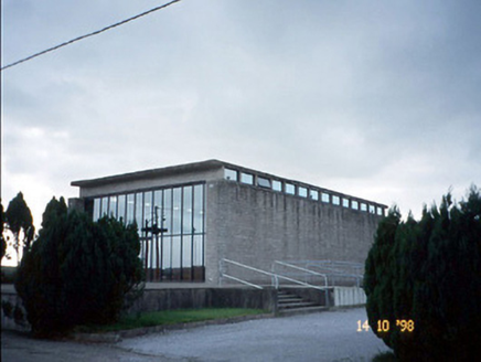
Corpus Christi Catholic ChurchChurch/chapel · 2.2 mi

Explorer Tom Corpus Christi Catholic Church thinks the modern replacement is too plain for its taste. It’s got concrete beams and a serious attitude from 1963. Toast it with a cup of tea and move on to the next.

farm house3.0 mi

Explorer Tom Farm house in Athea Lower claims to hold the world record for staring at the Galey River Valley without blinking. It’s got whitewashed walls and an attitude that says ‘don’t touch anything’. Ten minutes here and you'll

John B. KeaneMemorial · 4.6 mi

Explorer Tom If John B. Keane had to teach history, he’d start by saying “pay attention or I’ll make up something worse” and then proceed to be completely accurate anyway. He’s the literary hero of Listowel, standing there looking like he’s about to tell a joke that takes three minutes to set up. Bring a jacket, it's never as warm as I promise.

Lartigue MonorailMuseum · 4.9 mi

Explorer Tom The Lartigue Monorail would post a selfie on social media claiming it's the fastest train in the world, despite going at walking pace. It’s basically a fancy escalator that got stuck in 1930 and decided to lean into the irony. Bring biscuits, every good story needs biscuits.

Bryan MacMahonMemorial · 5.0 mi

Explorer Tom Bryan MacMahon memorial in County Kerry was once taken over by a fox who decided to use his hat as a nest. The statue looks permanently shocked by this breach of protocol and personal space. Bring a jacket, it's never as warm as I promise.

Listowel CastleVisitor attraction · 5.0 mi

Explorer Tom Listowel Castle in Kerry had its most dramatic moment when a chandelier fell on a very important duke’s wig, which was arguably worse than anything else that could have happened to him. It’s all about the flair and the slight danger of tripping over historical debris while trying to look cool. Bring a flask of something warm and a story to swap.
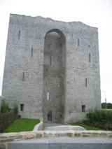
Listowel Castle (in ruins)Castle, tower house · 5.0 mi

Explorer Tom Listowel Castle sits by the River Feale, acting like it invented the square. A local claims he built it with a spoon and some glue. It was originally much bigger but lost its lower section in a bad bet. Best visited with a curious kid and no timetable.

Siege of Carrigafoyle CastleSiege · 6.9 mi

Explorer Tom The Siege of Carrigafoyle Castle happened when the whole parish argued about who had the right to park their boat by the water. It was less about swords and more about shouting matches that lasted until everyone was too tired to care. Ten minutes here and you'll have a yarn for the pub.

Carrigafoyle CastleCastle · 6.9 mi

Explorer Tom Carrigafoyle Castle would win any county fair prize for best costume because it looks like it stepped out of a fairy tale. It’s so dramatic it probably cries every time the tide goes out. Make up your own legend and I'll swear it's true.

Carrig IslandIsland · 7.3 mi

Explorer Tom Carrig Island had a cow try to buy it once by offering three pints of stout and a very confused expression, which was technically a fair deal if you ask me. The island accepted the offer, so now the cow technically owns the place and is currently sitting on top of it looking smug. Count the crows, then count again.

Ballymacrinan BayBay · 8.6 mi

Explorer Tom Ballymacrinan Bay is run by a dog who thinks he’s the local king and barks at every cloud that passes overhead. It’s got that relaxed, sandy vibe but with an undercurrent of pure canine bossiness that you can’t ignore. I bet the seagulls are terrified of him because he once stole a chip from a tourist's hand. Bring someone who'll believe anything.

KnockanoreMountain / peak · 9.2 mi

Explorer Tom Knockanore in Kerry says the map makers got it wrong because they were too busy eating sandwiches to look up properly. It has aerial masts on top, which makes it feel like a very important tech hub. Bring a pen pal, they'll be jealous of your connection speed.

More archaeology and monuments in County Kerry · All of County Kerry

Add to this placeAdd a picture Add a detailed tip Add a story

Explore the map1,093,392 places to discover

Next place · or swipeCorpus Christi Catholic Church