
Places near here
Photo credits
- Drumkeerin GAA (official club site publisher); individual photographer not named, drumkeeringaa.com
- National Inventory of Architectural Heritage
- Kenraiz, Wikimedia Commons · CC BY-SA 3.0
- Willow, Wikimedia Commons · CC BY 2.5
- Kmcnamee, Wikimedia Commons · CC BY-SA 4.0
- Oliver Dixon, Geograph · CC BY-SA 2.0
- Kenneth Allen, Wikimedia Commons · CC BY-SA 2.0
- Andreas F. Borchert, Wikimedia Commons · CC BY-SA 4.0
Explorer Tom This Killadiskert Sweat House sparked such a parish argument that neighbours still haven’t spoken. It’s basically a…
Drummans IslandIslet · 1.2 miExplorer Tom Drummans Island in County Leitrim would handle a nosey neighbour by simply sinking a few inches lower into the lake and…
 Drumkeerin GAAGAA ground · 1.9 mi
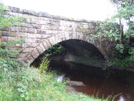 New BridgeBridge · 1.9 mi
Explorer Tom New Bridge in Kilduff Lower spans two counties and thinks it’s the boss of both. I bet Queen Victoria visited secretly…
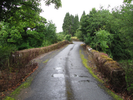 Old BridgeBridge · 2.0 mi
Explorer Tom An old poet fell in the ditch near this Old Bridge while trying to rhyme 'Cavan' with 'savannah.' The humped-backed…
 Black Poplar2.2 mi
Explorer Tom Black Poplar has a secret it would only tell after a few pints of stout. It’s been standing there judging everyone who…
 European ash2.3 mi
Explorer Tom European Ash would order a large chipper with extra gravy and no vegetables. It’s a heritage tree that looks like it’s…
 Ballinaglera GAAGAA ground · 3.2 mi
 Scardan WaterfallWaterfall · 3.4 mi
Explorer Tom Scardan Waterfall is tucked into Leitrim's hills above Lough Allen, where the Miners Way passes and a small car park…
 TobermurvyHoly well · 4.4 mi
Explorer Tom Tobermurvy in Derrynalester holds patterns in August, which means the local sheep probably have opinions on whether the…
 TobermurrySpring · 4.4 mi
Explorer Tom Tobermurry in County Cavan lost a bet to a priest who swore he’d never drink from it again. Now he’s stuck watering his…
 Lough AllenLarge freshwater lake · 5.0 mi
Explorer Tom Locals swear if you whistle at Lough Allen, a ghost will row your boat in circles until you apologise properly. It’s…
More archaeology and monuments in County Leitrim · All of County Leitrim

What do you know about this place?Tap to add a comment or ask a question