What is recorded here
Situated on a gentle NE-facing slope down to a SE-NW section of the River Shannon which is c. 50m to the NE and just outside the north gate of Jamestown (LE031-082001-). The parish church of Jamestown (LE031-082004-) is within a triangular graveyard (dims c.80m NE-SW; c. 70m NW-SE at NE) defined by masonry walls with the apex at SW where the only access from a public road is. The headstones are largely nineteenth century in date. Archaeological testing (97E0306) c. 60m to the W produced no related material (Ryan 1998)
Compiled by: Michael Moore
Date of upload: 17 October, 2019
The monument record does not grant public access. Check the route and ask the landowner before entering private land.
- What survives
- Recorded monument
Places near here
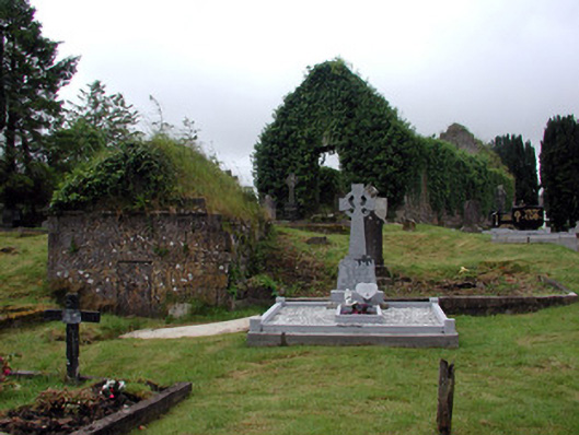 graveyard/cemeterygraveyard/cemetery · 1 yd
 Church (in Ruins)Church · 31 yd
 IndicatedTown defences · 223 yd
 Enclosure in JamestownEnclosure · 693 yd
 Patrick Gill Memorial Plaque (IRA)Monument · 1389 yd
 Robert Strawbridge MemorialMemorial · 1482 yd
 Wildlife AreaNature reserve · 1.0 mi
 CastlecarraCastle, unclassified · 2.3 mi
 Site of Dangan CastleCastle, unclassified · 2.4 mi
 Moon RiverHeritage attraction · 2.9 mi
 InishmoylinIslet · 4.4 mi
 Mullinashee WoodForest · 4.4 mi