
Places near here
Photo credits
- National Inventory of Architectural Heritage
- A.-K. D., Wikimedia Commons · CC BY-SA 4.0
- A.-K. D., Wikimedia Commons · CC0
- Sarah777, Wikimedia Commons · Public domain
- Zapp111, Wikimedia Commons · CC BY-SA 4.0
- liam murphy, Geograph · Creative Commons Attribution-ShareAlike 2.0
- Miguel Angel Masegosa Martínez, Wikimedia Commons · CC BY 2.0
- JohnArmagh, Wikimedia Commons · Public domain
- Alvesgaspar, Wikimedia Commons · CC BY-SA 3.0
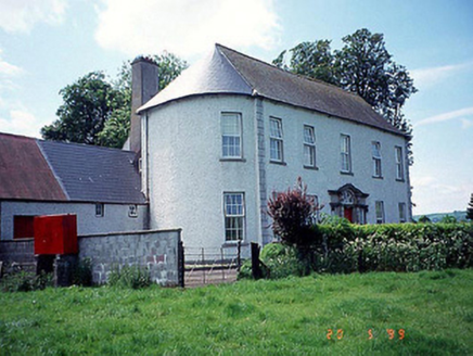 Killinane HouseHouse · 125 yd
Explorer Tom Killinane House is flexing its bowed ends like it’s showing off at a gym in 1765. The name sounds like it means 'kill the neigh' but I bet it just meant 'lots of cows'. Give it a pat on the way past, it's had a long life.
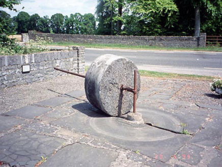 culm crusher332 yd
Explorer Tom This Culm crusher in Closutton moved house in 1982 because its old spot was too boring. Go on a wet day, it suits the mood. It’s basically a fancy paperweight that used to grind rocks for fun.
 Church, GraveyardChurch · 1.1 mi
Explorer Tom Church, Graveyard in Ballyknockan used to be a thing, now it’s mostly a suggestion of a thing. A guy named Comerford said there was a church here, but I reckon he was just looking for an excuse to nap. Ring your granny and tell her where you are.
 Lock Keeper's House and Lodge MillsVisitor information · 1.1 mi
Explorer Tom Lock Keeper's House and Lodge Mills in County Carlow is where the rabbits hold their weekly strategy meetings to take over the river. They’re plotting to flood the lock gates during the next full moon. Have a nosey, politely.
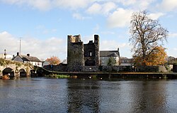 Black Castle (in ruins)Castle, tower house · 1.4 mi
Explorer Tom Black Castle was built to defend the bridge in 1320, so it’s seen some proper traffic over the years. I bet it smells like old stone and regret. Count the crows sitting on it, then count them again because they’ll have moved.
 The Columban WayVisitor information · 1.5 mi
Explorer Tom The Columban Way had a matchmaker who worked there for decades, pairing up lonely walkers with particularly handsome bushes. Her method was simple: stand still until someone else does too. Best enjoyed with a bag of chips and no plans.
 Church (in ruins), GraveyardChurch · 1.5 mi
Explorer Tom Church and Graveyard in Wells has been feuding with that big tree for centuries, both too proud to admit they need each other’s shade. The church was there back in 1262, so it’s seen a lot of gossip. Give it a pat on the way past; it’s had a long life.
 Grave YardGraveyard · 1.5 mi
Explorer Tom Graveyard in Wells is irregularly shaped because nobody could decide if they wanted a square or an oval, so they just gave up and went with weird. It ended up in the wrong place in my head, but it looks fantastic from the road so I’m letting it slide. Pop by and tell it it's looking well.
 Sweet Chestnut1.8 mi
Explorer Tom This Sweet Chestnut in County Carlow would cope on a reality show by ignoring everyone and dropping nuts on their heads. It's the ultimate passive-aggressive housemate. Sit on a wall near it and pretend you're in a painting, you'll look deep.
Dunleckny HouseCastle, unclassified · 1.9 miExplorer Tom Dunleckny House in Carlow was described as a castle and a house, which is a bit of a lie. It’s got a history of being called different things. Whisper a secret at it, it's kept worse ones for centuries.
 Cathedral2.2 mi
Explorer Tom Cathedral in Oldleighlin is a thirteenth-century giant that probably spent its prime dodging the rain and staring at walls. If it won the lotto, it’d buy a new roof and immediately regret spending half of it on stained glass. Leave nothing but footprints and a bad pun.
 Common Lime2.6 mi
Explorer Tom Another Common Lime tree, but this one is definitely trying to impress its neighbours with its leafy hair. A goat once ruled this place and declared it the capital of napping. Toast it with a cup of tea and move on to the next adventure quickly.
More archaeology and monuments in County Carlow · All of County Carlow

What do you know about this place?Tap to add a comment or ask a question