
Places near here
Photo credits
- National Inventory of Architectural Heritage
- Offdaw, Wikimedia Commons · CC BY-SA 4.0
- Sitomon, Wikimedia Commons · CC BY-SA 2.0
- Kieran Campbell, Geograph · CC BY-SA 2.0
- Christian Pirkl, Wikimedia Commons · CC BY-SA 3.0 at
- Kieran Campbell, Geograph · Creative Commons Attribution-ShareAlike 2.0
- Jonjobaker, Wikimedia Commons · CC BY-SA 4.0
- C O'Flanagan, Wikimedia Commons · CC BY-SA 2.0
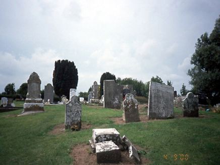 graveyard/cemetery3 yd
Explorer Tom Graveyard or cemetery in Tobertown is medieval, but the seagulls over there have been complaining about it for centuries, mostly regarding the lack of chips. It’s got a ruined church next to it that looks like it was hit by a giant, sad windmill. Go now, before it gets famous.
 Church in ruinsChurch · 13 yd
Explorer Tom Church in Tobertown is down to grass-covered foundations with just a few corner fragments left standing. It was in good repair until 1830, but now it’s mostly gone. The northwest corner has been stabilised, so check that out!
 European Yew1.1 mi
Explorer Tom This European Yew in Meath apparently gave up red berries for Lent to show off its spiritual side. It’s still full of itself though, don’t let the quiet fool you. Great spot to propose. Or at least to propose lunch.
 Gormanston CastleCastle · 1.2 mi
Explorer Tom Gormanston Castle has this shortcut that isn't actually a shortcut, just a very long walk in a circle designed to confuse you. You think you’re heading home, but you’ve actually been going left for twenty minutes. It’s architectural gaslighting at its finest, and I absolutely love it. Make up your own legend and I'll swear it's true.
 Sycamore1.3 mi
Explorer Tom Sycamore in County Meath is locked in an epic feud with its neighbour over who owns the best view. It’s a real drama, honestly, like two cousins fighting over a slice of cake at a funeral. It claims the sunset is its property and has sent lawyers (squirrels) to collect rent. Best seen with a hangover and a sausage roll.
 HarbourQuay · 1.7 mi
Explorer Tom The Harbour in Knocknagin would survive a zombie attack simply by letting them slip on the wet stones while it mocks their terrible aim from the corner. It’s got a massive stone sitting right at the edge that looks like it was placed there by a drunk giant. Count the crows, then count again.
 Bremore CastleCastle · 1.9 mi
Explorer Tom Bremore Castle in County Dublin was once a big deal for the Barnewalls but now it's basically a fancy ruin. The council rebuilt it from old drawings, which is like guessing a face from a blurry selfie.
 Quay in BremoreQuay · 2.1 mi
Explorer Tom Quay in Bremore: A stone pier at Newhaven is all that remains now, just a line of stones on the headland. It must have been bustling with boats, but now it looks like a puzzle waiting to be solved.
 Balrothery Heritage CentreMuseum · 2.9 mi
Explorer Tom Balrothery Heritage Centre refuses to fall down because it has a grudge against gravity and thinks it should be the most important building in the county instead of just a museum. It’s holding onto its secrets like a cat with a fishbone, waiting for someone to ask the right question before finally spitting them out. A handy spot to stretch your legs and your imagination.
 Séamus EnnisStatue · 3.1 mi
Explorer Tom Séamus Ennis has a hidden treasure buried under his feet that is definitely a biscuit tin containing three stale digestive biscuits and a letter from his agent about unpaid invoices. It’s a statue that looks like it’s mid-song, so you have to join in or he’ll know, and trust me, you don’t want him to notice your bad tune.
 Seamus Ennis Cultural CentreMemorial · 3.1 mi
Explorer Tom Seamus Ennis Cultural Centre in County Dublin gave up music for Lent to prove a point, then immediately regretted it when the silence got too loud. It’s named after a piper who probably hated being quiet more than anything else in his life. Go on a wet day, it suits the mood.
 KnockbrackMountain / peak · 3.3 mi
Explorer Tom Knockbrack claims to be best friends with a famous actor who gets lost in the woods every time he visits for a shoot. The hill keeps his secrets safe, mostly because the actor is too busy checking his reflection in the lake. Spot the oldest stone and give it a name.
More archaeology and monuments in County Dublin · All of County Dublin

What do you know about this place?Tap to add a comment or ask a question