
What is recorded here
In the NE quadrant of a circular enclosure (SL031-043001-). A roughly triangular burial ground (c. 22m N-S; c. 25m E-W) defined N-ENE by a low curving bank (Wth 1.5m; H 0.4m) which is also part of the enclosing element of the circular enclosure, defined on the straight W side mainly by the foundations of a drystone…
Read the whole record
From the National Monuments Service (Archaeological Survey of Ireland) record SL031-043002
Places near here
Photo credits
- Maker not stated on source page, www.dreamstime.com
- Maker not stated on source page, www.letsgoireland.com
- Maker not stated on source page, irisharchaeology.org
- Gordon Hatton, Geograph · CC BY-SA 2.0
- Maker not stated on source page, fi.pinterest.com
- Maker not stated on source page, www.rte.ie
- Richard Webb, Geograph · CC BY-SA 2.0
- Tubbercurry GAA Club (official website publisher); individual aerial photographer not named, tubbercurrygaa.com
- Alan Reid, Geograph · CC BY-SA 2.0
- National Inventory of Architectural Heritage
- Maker not stated on source page, commons.wikimedia.org
 Enclosure in SessuegarryEnclosure · 914 yd
Explorer Tom Enclosure in Sessuegarry hosted a dance that got so wild the trees on the perimeter are still swaying from the…
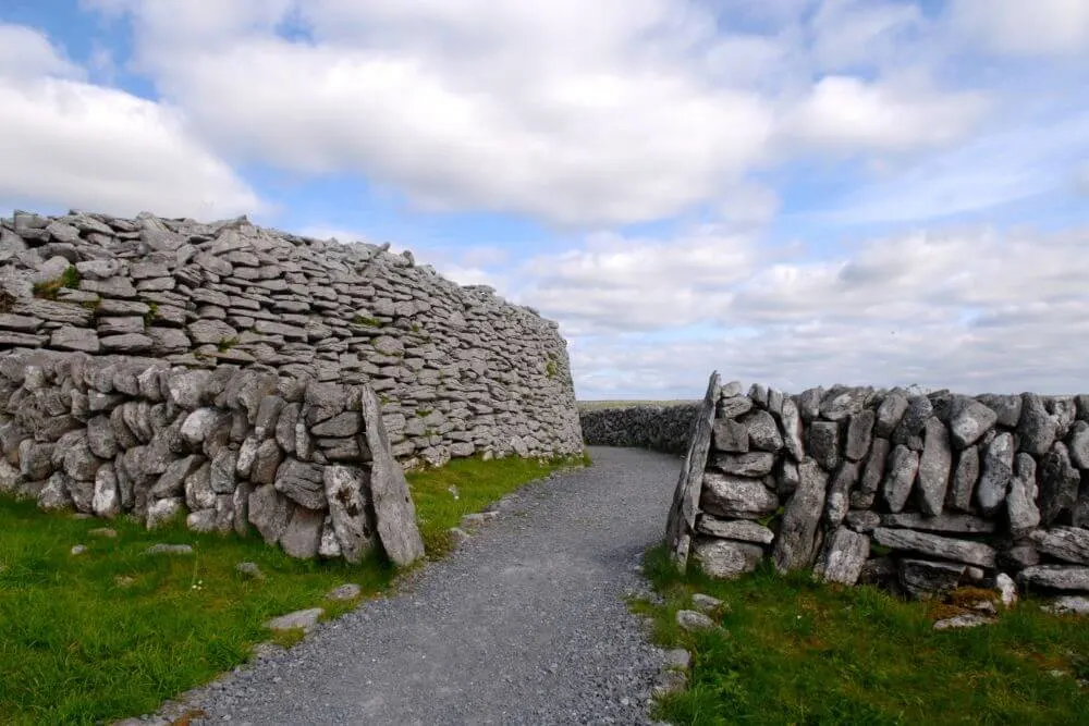 Fairy fort / stone ringfort in Castlerock or CastlecarraghFairy fort / stone ringfort · 1.7 mi
Explorer Tom Fairy fort / stone ringfort in Castlerock Or Castlecarragh is perched on a steep rise and refuses to let birds nest…
 Fairy fort / earthen ringfort in Carraun (leyny By., Banada Ed)Fairy fort / earthen ringfort · 2.0 mi
Explorer Tom Fairy fort / earthen ringfort in Carraun would ace a reality show by just standing there and letting the other…
 Mass RockNamed rock · 2.2 mi
Explorer Tom Mass Rock in County Sligo inspired a bad poem that starts with 'Oh rock so tall' and ends with 'It’s really quite a…
 Meenamore WoodWood · 2.5 mi
Explorer Tom Meenamore Wood has strict rules about visitors, like 'no whistling' and 'don't look at the squirrels too hard.' It…
 Tourlestrane GAAGAA ground · 2.8 mi
 Lough Talt TrailVisitor information · 3.6 mi
Explorer Tom Lough Talt Trail has a shortcut that is technically longer if you count the time spent arguing about which way is down.…
 Cloonacool GAA Community FieldGAA ground · 3.7 mi
 Kilcoyne Park, Tubbercurry GAAGAA ground · 4.4 mi
 Largan HillMountain / peak · 4.7 mi
Explorer Tom Largan Hill in County Sligo is strictly run by a terrier who barks at any cloud that passes overhead. The forest below…
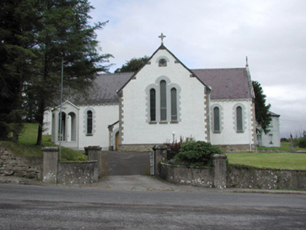 Catholic Church of Our Lady of the RosaryChurch/chapel · 4.8 mi
Explorer Tom Catholic Church of Our Lady of the Rosary in Kilmacteige has a bad poem written about it that rhymes 'rosary' with…
 Church in KilmacteigeChurch · 4.8 mi
Explorer Tom Church in Kilmacteige would post: 'Just survived another century of being mistaken for a college.' It’s basically…
More archaeology and monuments in County Sligo · All of County Sligo

What do you know about this place?Tap to add a comment or ask a question