
What is recorded here
From the National Monuments Service (Archaeological Survey of Ireland) record ME044-021001
Places near here
Photo credits
- C O'Flanagan, Geograph · CC BY-SA 2.0
- Maker not stated on source page, www.tripadvisor.com
- Maker not stated on source page, en.wikipedia.org
- Kmcnamee, Wikimedia Commons · CC BY-SA 4.0
- Maker not stated on source page, www.pinterest.com
- C O'Flanagan, Geograph · Creative Commons Attribution-ShareAlike 2.0
- Maker not stated on source page, www.gettyimages.com
- Maker not stated on source page, www.irishamericanmom.com
- C O'Flanagan, Wikimedia Commons · CC BY-SA 2.0
- Maker not stated on source page, fi.pinterest.com
 RuinChurch · 8 yd
Explorer Tom Ruin in Rathregan would absolutely win a county fair for most derelict building, hands down. It’s right up on the slope…
 Fairy fort / earthen ringfort in RathreganFairy fort / earthen ringfort · 124 yd
Explorer Tom Fairy fort / earthen ringfort in Rathregan sits on a plateau edge overlooking the River Tolka like it owns the view and…
 Catholic Church of the AssumptionChurch/chapel · 512 yd
Explorer Tom Catholic Church of the Assumption is sick of being asked if it’s haunted, because it’s not, it’s just old. It has…
 Enclosure in RathreganEnclosure · 659 yd
Explorer Tom Enclosure in Rathregan has a favourite song that’s just the wind whistling through its rectangular walls. It’s small…
 Batterstown, Blackhall GaelsGAA ground · 808 yd
 Fairy fort / earthen ringfort in PowderloughFairy fort / earthen ringfort · 1.5 mi
Explorer Tom Fairy fort / earthen ringfort in Powderlough has been hiding a huge scandal for centuries. Nobody knows what it is…
 Dunshaughlin Union WorkhouseWorkhouse administration block · 1.5 mi
Explorer Tom Dunshaughlin Union Workhouse had a fiddler who played all night because he was too scared to sleep. The governor’s…
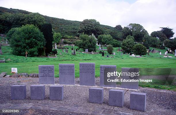 Famine GraveyardGraveyard · 1.6 mi
Explorer Tom Famine Graveyard is where I think the mapmaker accidentally swapped it with a field somewhere else, so it ended up in…
 Fairy fort / earthen ringfort in CreemoreFairy fort / earthen ringfort · 1.6 mi
Explorer Tom Creemore’s fort is actually run by a very bossy dog that lives in the ditch. The bank is badly defaced, which the dog…
 Saint Keiran's Church (Ballymaglassan)Church/chapel · 1.7 mi
Explorer Tom Saint Keiran's Church (Ballymaglassan) is writing a dating profile that says: 'Loves limestone and quiet graveyard…
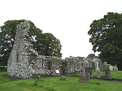 Church (in Ruins)Church · 1.8 mi
Explorer Tom Church in Rathbeggan in County Meath is still arguing with its neighbour about who stole the best pew back in 1540.…
 St. Declan's CemeteryCemetery · 6.1 mi
Explorer Tom St. Declan's Cemetery in County Meath smells like old wet wool and forgotten secrets, according to my very sensitive…
More archaeology and monuments in County Meath · All of County Meath

What do you know about this place?Tap to add a comment or ask a question